1
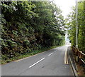
Lluest Farm access road
The access road on the left climbs away from the A4064.
Image: © Jaggery
Taken: 6 Sep 2014
0.15 miles
2
Bus stops and shelter north of Lluest
Alongside the A4064. A green sign near the bus shelter points left
towards a public footpath http://www.geograph.org.uk/photo/4159019 down into the Garw Valley.
Image: © Jaggery
Taken: 6 Sep 2014
0.16 miles
3
Public footpath descends to the Garw Valley
From the A4064 near the bus shelter seen here. http://www.geograph.org.uk/photo/4159018
Image: © Jaggery
Taken: 6 Sep 2014
0.17 miles
4
Northern approach to Lluest
Looking south along the A4064. The fence on the right is at the edge of a drop into the Garw Valley.
Image: © Jaggery
Taken: 6 Sep 2014
0.18 miles
5
Cycle Path and Railway in the Garw Valley
The track is now part of the Garw Valley Railway
Image: © John Finch
Taken: 7 Feb 2009
0.18 miles
6
Start of the pavement and double-yellow lines near Lluest
This walker was glad to have a pavement to use at last! The northern boundary sign for Lluest is ahead.
Image: © Jaggery
Taken: 6 Sep 2014
0.20 miles
7
Abutment alongside the A4064 north of Lluest
Located opposite a mining memorial. http://www.geograph.org.uk/photo/4158949
Maps show a dismantled tramway heading NE away from the top of the abutment.
Image: © Jaggery
Taken: 6 Sep 2014
0.20 miles
8
Coal dram detail in a memorial north of Lluest
Located here. http://www.geograph.org.uk/photo/4158949
Image: © Jaggery
Taken: 6 Sep 2014
0.20 miles
9
Mining memorial north of Lluest
Located on the west side of the A4064, above the Garw Valley, a former coal mining valley of major pits and small family-owned shafts. The memorial features a coal dram, http://www.geograph.org.uk/photo/4158952 a truck on rails used in mines.
Image: © Jaggery
Taken: 6 Sep 2014
0.20 miles
10
Coal dram and its surroundings north of Lluest
The coal dram is part of a mining memorial. http://www.geograph.org.uk/photo/4158949
The roofless remains of a building http://www.geograph.org.uk/photo/4155035 are on the left. An abutment http://www.geograph.org.uk/photo/4158991 is on the right.
Image: © Jaggery
Taken: 6 Sep 2014
0.21 miles


