IMAGES TAKEN NEAR TO
Park Street, BRIDGEND, CF32 8HD

Introduction

This page details the photographs taken nearby to Park Street, CF32 8HD by members of the Geograph project.

The Geograph project started in 2005 with the aim of publishing, organising and preserving representative images for every square kilometre of Great Britain, Ireland and the Isle of Man.

There are currently over 7.5m images from over14,400 individuals and you can help contribute to the project by visiting https://www.geograph.org.uk

Image Map


Images are licensed for reuse under creativecommons.org/licenses/by-sa/2.0
Notes
  • Clicking on the map will re-center to the selected point.
  • The higher the marker number, the further away the image location is from the centre of the postcode.

Image Listing (101 Images Found)

Images are licensed for reuse under creativecommons.org/licenses/by-sa/2.0
  • ...
Image
Details
Distance
1
Wood Street, Pontycymer
Viewed from Gelliron Cemetery.
Image: © Jaggery Taken: 6 Sep 2014
0.00 miles
2
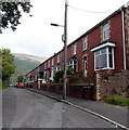
Park Street, Pontycymer
80 metre long row of houses viewed from the corner of Federation Lane.
Image: © Jaggery Taken: 6 Sep 2014
0.02 miles
3
Garw Valley Tennis Club, Pontycymer
Three tennis courts viewed from Federation Lane near the corner of Park Street.
Image: © Jaggery Taken: 6 Sep 2014
0.03 miles
4
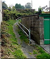
Track from Park Street to Alexandra Road, Pontycymer
From the southern end of Park Street. http://www.geograph.org.uk/photo/4162985
Image: © Jaggery Taken: 6 Sep 2014
0.03 miles
5
Federation Lane, Pontycymer
Looking east from the Meadow Street end, towards Park Street.
Image: © Jaggery Taken: 6 Sep 2014
0.04 miles
6
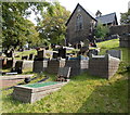
Gelliron Cemetery chapel, Pontycymer
The cemetery is located on a hillside at the eastern edge of the village.
Image: © Jaggery Taken: 6 Sep 2014
0.05 miles
7
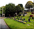
West side of Gelliron Cemetery, Pontycymer
The cemetery is on a hillside at the eastern edge of the village. This is the lowest level, near the main entrance from Alexandra Road.
Image: © Jaggery Taken: 6 Sep 2014
0.05 miles
8
Alexandra Road east of Meadow Street, Pontycymer
The steep gradient http://www.geograph.org.uk/photo/4150447 along Alexandra Road behind the camera is gentler ahead.
Image: © Jaggery Taken: 1 Sep 2014
0.05 miles
9
Gelliron Cemetery, Pontycymer
Viewed from high ground in the SE corner of the cemetery.
Image: © Jaggery Taken: 6 Sep 2014
0.06 miles
10
Football pitch in Pontycymer
Viewed from Federation Lane. Tennis courts and a bowling green are nearby.
Image: © Jaggery Taken: 6 Sep 2014
0.06 miles
  • ...