
IMAGES TAKEN NEAR TO
Gloucester Buildings, BRIDGEND, CF32 8DW
Introduction
This page details the photographs taken nearby to Gloucester Buildings, CF32 8DW by members of the Geograph project.
The Geograph project started in 2005 with the aim of publishing, organising and preserving representative images for every square kilometre of Great Britain, Ireland and the Isle of Man.

There are currently over 7.5m images from over14,400 individuals and you can help contribute to the project by visiting https://www.geograph.org.uk
Image Map
Images are licensed for reuse under creativecommons.org/licenses/by-sa/2.0
Notes
- Clicking on the map will re-center to the selected point.
- The higher the marker number, the further away the image location is from the centre of the postcode.
Image Listing (41 Images Found)
Images are licensed for reuse under creativecommons.org/licenses/by-sa/2.0
Image
Details
Distance
1
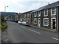
Gloucester Buildings, Pant-y-Gog
Houses viewed across the A4064 Pant-y-Gog. The name sign above the door on the right shows
GLOUCESTER BUILDINGS.
Image: © Jaggery
Taken: 6 Sep 2014
0.01 miles
2
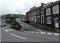
Junction, Pant-y-Gog
Thornton Crescent on the right climbs away from the A4064 Pant-y-Gog.
Image: © Jaggery
Taken: 6 Sep 2014
0.01 miles
3
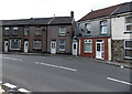
Houses on a bend in the A4064, Pant-y-Gog
Opposite Thornton Crescent. http://www.geograph.org.uk/photo/4153990
Image: © Jaggery
Taken: 6 Sep 2014
0.03 miles
4
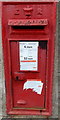
King Edward VII postbox, Gloucester Buildings, Pant-y-Gog
Located here. http://www.geograph.org.uk/photo/4154027 Notices stuck on the box give details
of changes to the latest collection times from the box.
Image: © Jaggery
Taken: 6 Sep 2014
0.03 miles
5
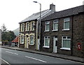
Southern end of Gloucester Buildings, Pant-y-Gog
Viewed across the A4064. The name sign on the wall of the leftmost house
shows GLOUCESTER BUILDINGS. The postbox on the right is Edwardian.
Image: © Jaggery
Taken: 6 Sep 2014
0.05 miles
6
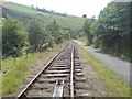
Disused railway line
Since the last colliery closed in the Garw Valley, the mineral line that ran its length saw little need of continuation. Listed as "Disused" on maps, much of the railway track has been lifted as can be seen here.
Image: © Hywel Williams
Taken: 15 Aug 2009
0.05 miles
7
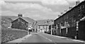
Northward on the A4064 in Cwm Garw approaching Pant-y-gog, 1962
A typical Welsh Valley scene more than 50 years ago, looking up Cuckoo Street towards the junction with New Street and Pant Street.
Image: © Ben Brooksbank
Taken: 1 Jun 1962
0.05 miles
8
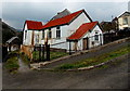
West side of Mount Zion Baptist Church, Pant-y-Gog
Viewed across New Street. See http://www.geograph.org.uk/photo/4154490 for another view and some details.
Image: © Jaggery
Taken: 6 Sep 2014
0.05 miles
9
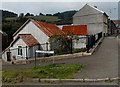
Mount Zion Baptist Church, Pant-y-Gog
In the former Salem Chapel building on the corner of New Street and the A4064, opposite Pant Street. From the late 19th century onwards, corrugated metal buildings were erected, usually as interim places of worship until a more substantial building could be afforded. Affectionately known as tin chapels, many have now gone. This survivor is in the Garw Valley north of Bridgend.
Image: © Jaggery
Taken: 6 Sep 2014
0.05 miles
10
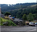
Electricity substation in Fenton Place, Pontycymer
The identifier on the Western Power Distribution electricity substation is PANT-Y-GOG S/S 563637.
Image: © Jaggery
Taken: 6 Sep 2014
0.06 miles