1
Gloucester Buildings, Pant-y-Gog
Houses viewed across the A4064 Pant-y-Gog. The name sign above the door on the right shows
GLOUCESTER BUILDINGS.
Image: © Jaggery
Taken: 6 Sep 2014
0.02 miles
2
Junction, Pant-y-Gog
Thornton Crescent on the right climbs away from the A4064 Pant-y-Gog.
Image: © Jaggery
Taken: 6 Sep 2014
0.02 miles
3
Houses on a bend in the A4064, Pant-y-Gog
Opposite Thornton Crescent. http://www.geograph.org.uk/photo/4153990
Image: © Jaggery
Taken: 6 Sep 2014
0.04 miles
4
King Edward VII postbox, Gloucester Buildings, Pant-y-Gog
Located here. http://www.geograph.org.uk/photo/4154027 Notices stuck on the box give details
of changes to the latest collection times from the box.
Image: © Jaggery
Taken: 6 Sep 2014
0.04 miles
5
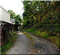
Track in Pant-y-Gog
The track heads east away from the A4064 Pant-y-Gog, opposite Gloucester Buildings. http://www.geograph.org.uk/photo/4153914
Image: © Jaggery
Taken: 6 Sep 2014
0.05 miles
6
Southern end of Gloucester Buildings, Pant-y-Gog
Viewed across the A4064. The name sign on the wall of the leftmost house
shows GLOUCESTER BUILDINGS. The postbox on the right is Edwardian.
Image: © Jaggery
Taken: 6 Sep 2014
0.05 miles
7
Northward on the A4064 in Cwm Garw approaching Pant-y-gog, 1962
A typical Welsh Valley scene more than 50 years ago, looking up Cuckoo Street towards the junction with New Street and Pant Street.
Image: © Ben Brooksbank
Taken: 1 Jun 1962
0.05 miles
8
Corner of Cuckoo Street and Pant Street in Pant-y-Gog
Pant Street http://www.geograph.org.uk/photo/4154005 is on the left. The A4064 through the Garw Valley has many local names. Here, it is Cuckoo Street.
Image: © Jaggery
Taken: 6 Sep 2014
0.05 miles
9
Pant Street, Pant-y-Gog
Pant Street climbs away from the A4064, opposite New Street.
Image: © Jaggery
Taken: 6 Sep 2014
0.05 miles
10
Mount Zion Baptist Church, Pant-y-Gog
In the former Salem Chapel building on the corner of New Street and the A4064, opposite Pant Street. From the late 19th century onwards, corrugated metal buildings were erected, usually as interim places of worship until a more substantial building could be afforded. Affectionately known as tin chapels, many have now gone. This survivor is in the Garw Valley north of Bridgend.
Image: © Jaggery
Taken: 6 Sep 2014
0.06 miles


