1
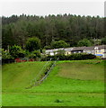
Steps up a bank to Nantymoel Row, Nantymoel
Viewed looking west from near Commercial Street.
Image: © Jaggery
Taken: 29 Aug 2018
0.04 miles
2
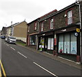
Bryant Centre, Commercial Street, Nantymoel
In late August 2018 the blue sign https://www.geograph.org.uk/photo/5888806 on the Bryant Centre shows
Fast Track Childcare Solutions Ltd - Nantymoel Playgroup.
Image: © Jaggery
Taken: 29 Aug 2018
0.04 miles
3
Blue name sign on the Bryant Centre, Nantymoel
On this https://www.geograph.org.uk/photo/5888802 building in August 2018.
Image: © Jaggery
Taken: 29 Aug 2018
0.04 miles
4
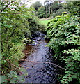
Infant River Ogmore in Nantymoel
The river flows towards this footbridge. https://www.geograph.org.uk/photo/5892756
Image: © Jaggery
Taken: 29 Aug 2018
0.05 miles
5
Ruchi in Nantymoel
Nepalese and Indian cuisine takeaway at 1C Commercial Street. Londis https://www.geograph.org.uk/photo/5888777 is on the left.
Image: © Jaggery
Taken: 29 Aug 2018
0.05 miles
6
Sealed building, Commercial Street, Nantymoel
Viewed in August 2018. This looks like a former public urinal, similar to urinals which remain in use in the nearby Rhondda, such as here https://www.geograph.org.uk/photo/3924285 in Cwmparc, but are now a rarity elsewhere in South Wales. Station Road houses are in the background.
Image: © Jaggery
Taken: 29 Aug 2018
0.05 miles
7
National Cycle Network Route 883 signpost, Nantymoel
Commercial Street Nantymoel is on the left. The cycle route ahead on the right uses the route of a dismantled railway on flat land near the River Ogmore. Nantymoel railway station which was nearby closed in 1958. Route 883 extends for nearly 7km through Ogmore Vale from Nantymoel to Blackmill where the route joins Route 4 which leads west to Port Talbot or east to Pontypridd.
Image: © Jaggery
Taken: 29 Aug 2018
0.06 miles
8
Nantymoel Londis
Londis convenience store at 1 Commercial Street Nantymoel.
Image: © Jaggery
Taken: 29 Aug 2018
0.06 miles
9
River Ogmore footbridge in Nantymoel
The bridge near Commercial Street crosses the infant River Ogmore. https://www.geograph.org.uk/photo/5892769
Image: © Jaggery
Taken: 29 Aug 2018
0.06 miles
10
River Ogmore Flowing Through Nant-y-Moel
Image: © Lewis Potter
Taken: 4 Apr 2013
0.06 miles


