1
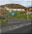
Junction of Blackmill Road and Lynn Davies Avenue, Lewistown
Viewed across the A4061 Blackmill Road.
Image: © Jaggery
Taken: 31 Oct 2018
0.02 miles
2
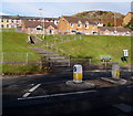
Pedestrian refuge, Blackmill Road, Lewistown
In the middle of the A4061 Blackmill Road near zigzag steps leading up to Danygraig Close.
Image: © Jaggery
Taken: 31 Oct 2018
0.02 miles
3
A view over Lewistown and farmland in the Ogmore Valley
A photograph taken on a high track - also a public footpath - at a point by the south west corner of Ogmore Forest.
Image: © eswales
Taken: 9 Jun 2009
0.02 miles
4
Flying Start, Lewistown
Set below Blackmill Road, Flying Start provides playgroups mainly for children aged 2½ - 5,
usually for 2 to 3 hours in the morning or afternoon, mainly during term time.
Image: © Jaggery
Taken: 31 Oct 2018
0.03 miles
5
Two Blackmill Road bus stops, Lewistown
The stop on the left is for buses to Nantymoel via Ogmore Vale.
The stop on the right is for buses to Bridgend via Blackmill, Bryncethin and Sarn.
Image: © Jaggery
Taken: 31 Oct 2018
0.04 miles
6
Lewistown nestling in the Ogmore Valley
Taken from the Llangeinor to Blackmill road
Image: © John Finch
Taken: 27 Nov 2011
0.05 miles
7
Access road to sports fields in Lewistown
From the east side of Blackmill Road to sports fields on flat land on a bank of the Ogwr Fawr river.
Image: © Jaggery
Taken: 31 Oct 2018
0.05 miles
8
Long row of houses, Pentre Beili Terrace, Lewistown
Viewed from Blackmill Road near the Lynn Davies Avenue junction.
Image: © Jaggery
Taken: 31 Oct 2018
0.05 miles
9
Queen Elizabeth II postbox and a telecoms cabinet, Blackmill Road, Lewistown
Viewed across the A4061 Blackmill Road in October 2018.
The red phonebox near the postbox seen in a June 2011
Google Earth Street View has been removed.
Image: © Jaggery
Taken: 31 Oct 2018
0.05 miles
10
Houses in the north of Lewistown
Viewed across the A4061 Blackmill Road. Pentre Beili Place houses are on higher ground.
Image: © Jaggery
Taken: 31 Oct 2018
0.08 miles


