1
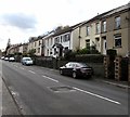
Semi-detached houses, Cemetery Road, Ogmore Vale
On the west side of the A4061 Cemetery Road on the northern approach to Pwllypant Cemetery.
Image: © Jaggery
Taken: 14 Nov 2018
0.01 miles
2
Cemetery Road houses, Ogmore Vale
Above the west side of the A4061 Cemetery Road.
Image: © Jaggery
Taken: 14 Nov 2018
0.02 miles
3
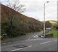
Bridgend District : Hillside Scenery
Looking up the hillside towards the trees and woodland.
Image: © Lewis Clarke
Taken: 23 Mar 2014
0.03 miles
4
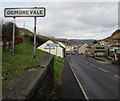
Ogmore Vale name sign
Village name sign on the right here https://www.geograph.org.uk/photo/5975480 facing the A4061 Cemetery Road at the Bryn Road junction.
Image: © Jaggery
Taken: 14 Nov 2018
0.04 miles
5
Junction of Bryn Road and Cemetery Road, Ogmore Vale
Viewed across the A4061 Cemetery Road.
Image: © Jaggery
Taken: 14 Nov 2018
0.04 miles
6
Former railway route south of Bridge Street, Ogmore Vale
Now (November 2018) a combined footpath/cycleway towards Lewistown.
The rugby posts on the left are in the home ground of Ogmore Vale RFC.
Image: © Jaggery
Taken: 14 Nov 2018
0.05 miles
7
Nisa articulated lorry, Ogmore Vale
Travelling north on the A4061 Cemetery Road.
Image: © Jaggery
Taken: 14 Nov 2018
0.06 miles
8
Northern edge of Pwllypant Cemetery, Ogmore Vale
Hillside cemetery above the west side of the A4061 Cemetery Road.
Image: © Jaggery
Taken: 14 Nov 2018
0.06 miles
9
LC Martial Arts name sign, Cemetery Road, Ogmore Vale
In November 2018 the name sign shows The Home of Nantymoel Tang Soo Do.
A June 2011 Google Earth Street View shows a Kingdom Hall of Jehovah's Witnesses in this building.
Image: © Jaggery
Taken: 14 Nov 2018
0.06 miles
10
Derelict former fuel filling station and shop in Ogmore Vale
Alongside the A4061 Cemetery Road viewed in November 2018. This site has been derelict for many years.
A June 2011 Google Earth Street View shows boarded-up premises here with four fuel pumps still in place.
Image: © Jaggery
Taken: 14 Nov 2018
0.07 miles


