1
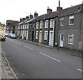
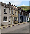
Houses on the east side of Llywelyn Street, Ogmore Vale
Looking north towards Commercial Street and Tynewydd Row.
Image: © Jaggery
Taken: 25 Aug 2018
0.01 miles
2
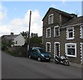
Three-storey house, Llywelyn Street, Ogmore Vale
Located on the left here https://www.geograph.org.uk/photo/5886536 at the northern end of a long row of two-storey houses.
Image: © Jaggery
Taken: 25 Aug 2018
0.01 miles
3
Llywelyn Street looking north
Image: © Colin Pyle
Taken: 15 Jul 2012
0.02 miles
4
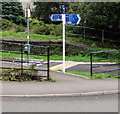
National Cycle Network Route 883 signpost, Commercial Street, Ogmore Vale
Near the remains of Ogmore Vale railway station https://www.geograph.org.uk/photo/6162110 where passenger services ended in 1958. The former railway route is part of National Cycle Network Route 883 from Blackmill to Nant-y-moel via Ogmore Vale.
Image: © Jaggery
Taken: 23 Aug 2018
0.03 miles
5
Site of Ogmore Vale Station
The site has had a lick of paint since
Image
Image: © John Light
Taken: 5 Jan 2012
0.03 miles
6
Commercial Street speed bump, Ogmore Vale
Painted white triangles draw attention to a gentle bump across Commercial Street. The pink strip is where a railway line formerly crossed the road near Ogmore Vale railway station where passenger services ended in 1958. The former railway route is now a combined cycleway and footpath, part of National Cycle Network Route 883.
Image: © Jaggery
Taken: 23 Aug 2018
0.03 miles
7
Chapel conversion beside community route at Ogmore Vale
Image: © Mick Lobb
Taken: 16 Sep 2008
0.03 miles
8
Commercial Street houses and a shop, Ogmore Vale
The shop is on the right.
Image: © Jaggery
Taken: 23 Aug 2018
0.03 miles
9
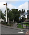
Old semaphore signal, Commercial Street, Ogmore Vale
Near the remains of Ogmore Vale station where passenger services ended in 1958.
Image: © Jaggery
Taken: 23 Aug 2018
0.03 miles
10
Old level crossing at Ogmore Vale
What was the railway is now a cycle track. To the left is the old Wesley Chapel, now a carpet warehouse. Changing times!
Image: © Alan Hughes
Taken: 3 Sep 2023
0.03 miles


