1
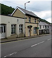
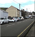
Rhiwglyn Road, Ogmore Vale
From the east side of High Street, Rhiwglyn Road leads to Glyn Street.
Image: © Jaggery
Taken: 25 Aug 2018
0.02 miles
2
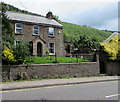
Broad Ash, High Street, Ogmore Vale
Stone house set above the east side of the A4061 High Street.
Image: © Jaggery
Taken: 25 Aug 2018
0.03 miles
3
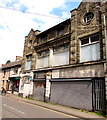
Former Co-operative Wholesale Society Building, High Street, Ogmore Vale
The Cadw website records that the building was erected c1910 by the Co-operative Wholesale Society as a local department store serving the Ogmore Valley. The ground floor contained a grocery shop and the Co-op Shop where payment was made. The upper floor was for haberdashery, drapery and millinery. The shop closed c1977. Grade II listed in 1997 as a well-detailed commercial building for the Co-operative Society which played a major role in the development of the valleys and of interest for its Arts & Crafts influence.
Image: © Jaggery
Taken: 25 Aug 2018
0.04 miles
4
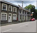
Ogmore Vale : High Street
The road through the centre of Ogmore Vale.
Image: © Lewis Clarke
Taken: 23 Mar 2014
0.04 miles
5
High Street scaffolding, Ogmore Vale
Viewed across the A4061 High Street on August 25th 2018.
Image: © Jaggery
Taken: 25 Aug 2018
0.04 miles
6
King George VI postbox in a High Street wall, Ogmore Vale
Located here. https://www.geograph.org.uk/photo/6040342 King George VI reigned from December 11th 1936 to February 6th 1952.
Image: © Jaggery
Taken: 25 Aug 2018
0.04 miles
7
East side of High Street, Ogmore Vale
Between Rhiwglyn Road and Fern Street, viewed across the A4061.
Image: © Jaggery
Taken: 25 Aug 2018
0.04 miles
8
A view of Ogmore Vale and Cwm Ogwr Fawr
A view from a track which begins at Ogmore Vale and runs alongside the village for some distance before climbing quite steeply up into Ogmore Forest. Mynydd Llangeinwyr runs above the valley to its west.
Image: © eswales
Taken: 9 Jun 2009
0.05 miles
9
The Eye Centre in Ogmore Vale
Optician at 88 High Street, next door to the former Co-operative Wholesale Society building. https://www.geograph.org.uk/photo/6040387
Image: © Jaggery
Taken: 25 Aug 2018
0.05 miles
10
On-street parking, High Street, Ogmore Vale
On the west side of the A4061 High Street.
Image: © Jaggery
Taken: 25 Aug 2018
0.06 miles


