1
Cycle path and houses at Broadlands
A stream flows between the two, alongside the line of vegetation seen running across the image.
Image: © eswales
Taken: 24 Aug 2021
0.14 miles
2
Bryntirion College
Wales Evangelical School of Theology, Bryntirion, Bridgend.
Image: © Alan Hughes
Taken: 10 Feb 2016
0.17 miles
3
Cycle route, Broadlands
A cycle route meandering along a pleasant green corridor in the west of Broadlands. The path runs to the centre of the Bridgend suburb and, thereafter, towards the centre of the town itself.
Note that this image is of the more northerly of two branches which maps indicate the cycle route at Broadlands divides into to the west of the B4622.
Image: © eswales
Taken: 24 Aug 2021
0.17 miles
4
Entrance to WEST in Bryntirion
Set back from the south side of the A473 Bryntirion Hill.
WEST is the acronym of Wales Evangelical School of Theology.
Image: © Jaggery
Taken: 24 Dec 2014
0.17 miles
5
Union Wales Campus
Union School of Theology is a Christian Only Faculty
Entrance (For some reason the signage is all at the Exit)
Image: © Steve Barnes
Taken: 5 Apr 2020
0.18 miles
6
The start of a cycle path in the north west of Broadlands
This cycle path strikes out from a spot on Heol Blandy and runs towards the centre of Broadlands. From there it is possible to continue towards the centre of Bridgend. A junction of the cycle path with a footpath is seen in the image.
Note that this image is of the more northerly of two branches which maps indicate the cycle route at Broadlands divides into to the west of the B4622.
Image: © eswales
Taken: 24 Aug 2021
0.20 miles
7
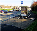
Cycle path past a Bryntirion Hill bus shelter in Bridgend
According to the blue sign, cyclists should go on the right side of the bus shelter,
walkers on the left (road) side. I wonder how many walkers do so...
Image: © Jaggery
Taken: 24 Dec 2014
0.21 miles
8
Union Wales Campus & Grace Church
Union School of Theology is a Christian Only Faculty
Exit Only (For some reason the signage is all at the Exit).
Image: © Steve Barnes
Taken: 5 Apr 2020
0.21 miles
9
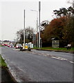
Two telecoms masts alongside the A473 in Bryntirion
Near a bus stop and shelter on the south side of the A473.
Image: © Jaggery
Taken: 16 Nov 2018
0.21 miles
10
Cycle Track
Cycle track in Broadlands, Bridgend.
Image: © Alan Hughes
Taken: 10 Feb 2016
0.21 miles


