1
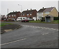
West side of Bright Hill, Bridgend
Semi-detached houses and a bus shelter on the west side of Bright Hill (Bryngolau in Welsh).
Image: © Jaggery
Taken: 16 Nov 2018
0.04 miles
2
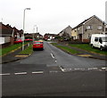
Two-storey block of flats, Bright Hill, Bridgend
Set back from the west side of Bright Hill (Bryngolau in Welsh).
Image: © Jaggery
Taken: 16 Nov 2018
0.04 miles
3
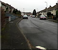
Bright Hill north of Beechwood Avenue, Bridgend
Bright Hill is the English name of the street named Bryngolau in Welsh.
Image: © Jaggery
Taken: 24 Dec 2014
0.06 miles
4
Bryntirion Infant School, Bridgend
Viewed from the Bryngolau entrance gate http://www.geograph.org.uk/photo/4293219 looking towards the brick building dating from 1956. There are c140 children enrolled, either in the nursery unit (ages 3-4) or one of four infant classes (ages 4-7).
Image: © Jaggery
Taken: 24 Dec 2014
0.09 miles
5
West side of Ael-y-bryn, Bridgend
Brick semi-detached houses viewed from the corner of Queen's Road (Heol-y-frenhines in Welsh).
Image: © Jaggery
Taken: 16 Nov 2018
0.09 miles
6
Erw Deg, Bridgend
Looking to the northwest along Erw Deg from Bright Hill (Bryngolau in Welsh).
Image: © Jaggery
Taken: 16 Nov 2018
0.10 miles
7
South along Ael-y-bryn, Bridgend
From Queen's Road (Heol-y-frenhines in Welsh) along Ael-y-bryn towards Beechwood Avenue.
Image: © Jaggery
Taken: 16 Nov 2018
0.10 miles
8
Bryntirion Infants School
Bryntirion Infants School, Bridgend.
Image: © Alan Hughes
Taken: 10 Feb 2016
0.10 miles
9
Greenmeadow/Ton Glas, Bryntirion, Bridgend
Looking east along Greenmeadow (Ton Glas in Welsh) from the corner of Broad Oak Way.
Image: © Jaggery
Taken: 16 Nov 2018
0.11 miles
10
Queen's Road pillarbox and phonebox, Bridgend
Queen's Road is Heol-y-frenhines in Welsh.
Image: © Jaggery
Taken: 16 Nov 2018
0.11 miles


