1
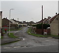
Beechwood Avenue, Bridgend
From Heol-y-frenhines along Beechwood Avenue towards Bryngolau (Bright Hill in English).
The walker is on the corner of Philip Avenue.
Image: © Jaggery
Taken: 16 Nov 2018
0.04 miles
2
Beechwood Avenue, Bridgend
Viewed from the corner of Bryngolau/Bright Hill.
Image: © Jaggery
Taken: 24 Dec 2014
0.06 miles
3
Entrance gate to Llangewydd Junior School, Bridgend
This entrance is from Queen's Road near the corner of Beechwood Avenue.
The nameboard https://www.geograph.org.uk/photo/5984397 shows that Llangewydd Junior School is Ysgol Iau Llangewydd in Welsh.
Image: © Jaggery
Taken: 16 Nov 2018
0.08 miles
4
Ysgol Iau Llangewydd/Llangewydd Junior School name board, Bridgend
The Welsh/English nameboard is here. https://www.geograph.org.uk/photo/5984391
The English version of the school motto on the board is Forward Together.
Image: © Jaggery
Taken: 16 Nov 2018
0.08 miles
5
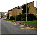
West side of Ael-y-bryn, Bridgend
Brick semi-detached houses viewed from the corner of Queen's Road (Heol-y-frenhines in Welsh).
Image: © Jaggery
Taken: 16 Nov 2018
0.09 miles
6
Zigzag yellow markings on Heol-y-frenhines, Bridgend
Marking the Keep Clear Zone near Llangewydd Junior School
Image: © Jaggery
Taken: 16 Nov 2018
0.09 miles
7
Old Milestone by the A473, Bryntirion Hill, Bridgend parish
Glamorgan Gothic by the A473 (was A48), in parish of Bridgend (Bridgend County Borough District), Bryntirion Hill, 100m East of junction with the B4622, against wall.
Inscription reads:-
: TO / BRIDGEND / 1 : : BRIDGEND DISTRICT : : TO / PYLE / 5 : : LONDON / 178 : : NEWCASTLE PARISH :
Surveyed
Milestone Society National ID: GLA_178BEPY01
Image: © Milestone Society
Taken: Unknown
0.09 miles
8
South along Ael-y-bryn, Bridgend
From Queen's Road (Heol-y-frenhines in Welsh) along Ael-y-bryn towards Beechwood Avenue.
Image: © Jaggery
Taken: 16 Nov 2018
0.09 miles
9
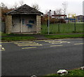
Queen's Road bus stop and shelter, Bridgend
This stop is for buses to Bridgend bus station.
Image: © Jaggery
Taken: 16 Nov 2018
0.10 miles
10
Former Police Station
This former police station still shows up on the OS maps but is now used to run a counselling business.
Image: © Steve Barnes
Taken: 16 Jun 2019
0.10 miles


