1
Private road leading to Borderknot Ltd in Margam House, Bridgend
There is no name sign on this street on the south side of Park Street.
Instead, a sign shows Borderknot Ltd PRIVATE PROPERTY Residents Parking Only.
UNAUTHORISED VEHICLES WILL BE CLAMPED. Site managed by Seel & Co.
Image: © Jaggery
Taken: 24 Dec 2014
0.06 miles
2
King George V postbox on a corner in Bridgend
In the wall http://www.geograph.org.uk/photo/4293484 on the corner of St Leonard's Road and Park Road.
George V was king from May 6th 1910-January 20th 1936.
Image: © Jaggery
Taken: 24 Dec 2014
0.08 miles
3
Bridgend : Park Street A473
A road heading out from the centre of Bridgend.
Image: © Lewis Clarke
Taken: 24 Aug 2014
0.08 miles
4
St Margaret's Court, Bridgend
Containing six flats, St Margaret's Court is set back from the north
side of the A473 Park Street west of the St Leonard's Road junction.
Image: © Jaggery
Taken: 24 Dec 2014
0.08 miles
5
Bridgend : Park Street A473
Park Street heading into the centre of Bridgend.
Image: © Lewis Clarke
Taken: 24 Aug 2014
0.10 miles
6
St Leonard's Road, Bridgend
St Leonard's Road heads north away from the A473 Park Street, towards West Road.
The postbox http://www.geograph.org.uk/photo/4293495 in the wall is from the reign of King George V (May 6th 1910-January 20th 1936).
Image: © Jaggery
Taken: 24 Dec 2014
0.10 miles
7
Bridgend : St Leonard's Road
A road heading between Park Street and West Road.
Image: © Lewis Clarke
Taken: 24 Aug 2014
0.10 miles
8
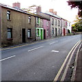
Row of houses on the south side of Park Street Bridgend
Looking WSW from nearly opposite this http://www.geograph.org.uk/photo/4291570 Quaker Meeting House.
Image: © Jaggery
Taken: 24 Dec 2014
0.10 miles
9
Cottages in Park St, Bridgend
Image: © John Lord
Taken: 26 May 2011
0.10 miles
10
Path in green space at north-eastern edge of Broadlands, Bridgend
The path meets the Broadlands Cycle Route on just the other side of the trees.
Image: © eswales
Taken: 8 Jun 2021
0.11 miles


