1
St John's Priory, Bridgend
The building on the corner of Merthyr Mawr Road (North) and the A473 has been converted to several flats.
Image: © Jaggery
Taken: 18 Apr 2017
0.03 miles
2
A473 pelican crossing, Bridgend
Pelican crossing across the A473 viewed from Merthyr Mawr Road (North).
Image: © Jaggery
Taken: 18 Apr 2017
0.04 miles
3
Nolton Hall, Bridgend
Church hall on the southeast side of St Mary's Church Nolton. http://www.geograph.org.uk/photo/5356100
Image: © Jaggery
Taken: 18 Apr 2017
0.04 miles
4
Southern end of Merthyr Mawr Road (North), Bridgend
The entrance to St John's Priory http://www.geograph.org.uk/photo/5374721 is on the left. The A473 is on the right.
Image: © Jaggery
Taken: 18 Apr 2017
0.04 miles
5
King George V postbox in a Merthyr Mawr Road (North) wall, Bridgend
Located here. http://www.geograph.org.uk/photo/5374722 The GR on the box is short for Georgius Rex,
Latin for King George, in this case King George V
who reigned from May 1910-January 1936.
Image: © Jaggery
Taken: 18 Apr 2017
0.04 miles
6
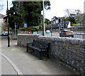
Bench at the southern end of Merthyr Mawr Road (North), Bridgend
The cars on the right are on the A473.
Image: © Jaggery
Taken: 18 Apr 2017
0.04 miles
7
Bridgend, St. Mary's Nolta
Late Victorian parish church: http://parish.churchinwales.org.uk/l031/churches/nolton/
Image: © Mike Faherty
Taken: 12 Jul 2016
0.05 miles
8
Row of houses, South Street, Bridgend
The houses are set back 25 metres from the north side of South Street.
Image: © Jaggery
Taken: 30 Mar 2014
0.05 miles
9
Large Celtic cross in St Mary's Nolton churchyard, Bridgend
The dedication on the base of the cross is
In Thankful and Blessed Memory of Frederic William Edmondes,
Rector of this Parish from 1873 to 1901 and for 16 years
Archdeacon of Llandaff. Born August 22 1840. Died November 10 1918.
LAUS DEO (Latin for Praise be to God).
Nolton Hall http://www.geograph.org.uk/photo/5356113 is in the background.
Image: © Jaggery
Taken: 18 Apr 2017
0.05 miles
10
West side of St Mary's Church Nolton Bridgend
Viewed across Merthyr Mawr Road (North). The church is part of the Parish of Coity, Nolton & Brackla in the Church in Wales Diocese of Llandaff. The building was consecrated in November 1887. The spire was added in 1897. Grade II listed in 1986.
Image: © Jaggery
Taken: 18 Apr 2017
0.05 miles


