1
House by Sarn Park
Image: © M J Richardson
Taken: 29 Oct 2014
0.15 miles
2
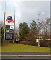
Bridgend Designer Outlet name board
Bridgend Designer Outlet is also called McArthurGlen Designer Outlet or (locally) The Pines.
I don't know what the contraption on the right is. There seems to be a camera on the post,
but it is focused on the ground. Power is generated by a solar panel and a small wind turbine.
Image: © Jaggery
Taken: 7 Dec 2012
0.17 miles
3
Road Junction at Sarn Park
With the back of Sainsbury's store across the road - part of the Sarn Park Designer Outlet Village.
Image: © M J Richardson
Taken: 29 Oct 2014
0.18 miles
4
Suburban cattle grid
At Sarn Park, on the side road leading down to Ty'n-y-garn.
Image: © M J Richardson
Taken: 29 Oct 2014
0.18 miles
5
Bridgend Outlet Shopping Village - Sarn Park
An odd junction, since the 'main road' leads into the shops, while the side road to the left continues on to other places.
Image: © M J Richardson
Taken: 29 Oct 2014
0.18 miles
6
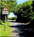
A4063 cattle grid, Sarn near Bridgend
The sign on the left directs those driving horse-drawn carriages and those in charge of other animals
to the gate on the right, to bypass the grid.
Image: © Jaggery
Taken: 7 Dec 2012
0.18 miles
7
Sainsbury's delivery area, The Derwen near Bridgend
A Sainsbury's lorry is being unloaded in the delivery area in the SE corner of the Sainsbury's superstore.
Image: © Jaggery
Taken: 7 Dec 2012
0.19 miles
8
Bilingual warning sign near Bridgend
Showing Cattle grid and the Welsh Grid gwartheg, the sign is 50 yards from this grid. http://www.geograph.org.uk/photo/3378723
Image: © Jaggery
Taken: 17 Jun 2017
0.20 miles
9
Sainsbury's, The Derwen near Bridgend
Located near Bridgend Designer Outlet (also called McArthurGlen Designer Outlet or The Pines.)
Image: © Jaggery
Taken: 7 Dec 2012
0.21 miles
10
Ordnance Survey Cut Mark
This OS cut mark can be found on the wall south of the entrance to The Parc. It marks a point 65.536m above mean sea level.
Image: © Adrian Dust
Taken: 26 May 2018
0.21 miles


