
IMAGES TAKEN NEAR TO
Cyril Crescent, CARDIFF, CF24 1DQ
Introduction
This page details the photographs taken nearby to Cyril Crescent, CF24 1DQ by members of the Geograph project.
The Geograph project started in 2005 with the aim of publishing, organising and preserving representative images for every square kilometre of Great Britain, Ireland and the Isle of Man.

There are currently over 7.5m images from over14,400 individuals and you can help contribute to the project by visiting https://www.geograph.org.uk
Image Map
Images are licensed for reuse under creativecommons.org/licenses/by-sa/2.0
Notes
- Clicking on the map will re-center to the selected point.
- The higher the marker number, the further away the image location is from the centre of the postcode.
Image Listing (82 Images Found)
Images are licensed for reuse under creativecommons.org/licenses/by-sa/2.0
Image
Details
Distance
1
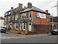
Roath Conservative Club, Cardiff
Seen here from Broadway, the club occupies a site bordered by Broadway, Cyril Street and Stacey Road. Dating from the 1870s, the current appearance of the building can best be described as faded grandeur.
Engraved in stone above a doorway on the Cyril Street side of the building (in this view, the doorway between two windows, next to the car) is TREDEGAR HALL.
Image: © Jaggery
Taken: 15 Jul 2010
0.04 miles
2
Church premises and playgroup, Broadway, Cardiff
Cardiff City Church premises at 23-25 Broadway. The right side of the premises is
Les Petits Filous, playgroup for the under-fives.
Image: © Jaggery
Taken: 15 Jul 2010
0.04 miles
3
Beamrite and A&C, Broadway, Cardiff
Two shops on Broadway, between Cyril Street and Helen Place :
17 Broadway : Beamrite Aerials, digital aerial satellite specialists.
19 Broadway : A & C Domestics, refrigeration and washing machine centre.
Image: © Jaggery
Taken: 15 Jul 2010
0.04 miles
4
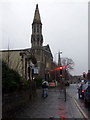
November afternoon in Cardiff
Looking west along Newport Road: the first spire belongs to yet another redundant church, on the corner of Upper Clifton Street, now an outlet for art and craft materials; the second marks Trinity Methodist church.
Image: © Natasha Ceridwen de Chroustchoff
Taken: 29 Nov 2007
0.05 miles
5
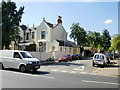
Cardiff : corner of Partridge Road and Newport Road
Partridge Road heads away from Newport Road towards Crofts Street.
Image: © Jaggery
Taken: 9 Sep 2009
0.06 miles
6

The Clifton
Public house on the corner of Clifton Street and Broadway
Image: © Eirian Evans
Taken: 17 Dec 2024
0.07 miles
7
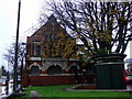
Roath public library
On the apex of Newport Road and Four Elms Road. Built at the end of the C19 when churches, schools and other public facilities sprang up to meet the needs of the expanding population of this part of Cardiff.
Image: © Natasha Ceridwen de Chroustchoff
Taken: 29 Nov 2007
0.07 miles
9
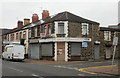
Ideal Restaurant, Broadway, Cardiff
An ideal restaurant should, ideally, open at least occasionally. This one, on the corner of Broadway and Richards Place, with its entrance doorway boarded up, appears not to have opened recently.
Image: © Jaggery
Taken: 15 Jul 2010
0.08 miles
10
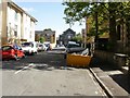
Oakfield Street, Cardiff
Looking towards Stacey Road from Newport Road. The grey building in the middle distance is the former Yamaha School of Music, Stacey Road. http://www.geograph.org.uk/photo/1975051
Image: © Jaggery
Taken: 9 Sep 2009
0.08 miles