1
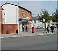
Adamsdown Post Office, Cardiff
Located at 11 Moira Place, inside McColl's Stores, previously a Londis store.
Image: © Jaggery
Taken: 3 Sep 2010
0.03 miles
2
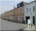
Big trees and small gardens, Constellation Street, Cardiff
There is something a little disquieting on turning the corner from Moira Place into Constellation Street to see large trees growing in tiny front gardens of houses on the south side of the street.
Image: © Jaggery
Taken: 3 Sep 2010
0.04 miles
3
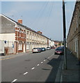
Augusta Street, Adamsdown, Cardiff
Houses on the SE side of the street, viewed from the Moira Place end. A row of black posts blocks off traffic from entering this end of Augusta Street. Vehicular access is from Meteor Street, at the far end of the street.
Image: © Jaggery
Taken: 3 Sep 2010
0.06 miles
4
The New Addie, Cardiff
Corner of Meteor St and Moira St
Image: © John Lord
Taken: 8 May 2010
0.07 miles
5
South Luton Place, Adamsdown, Cardiff
Houses on the east side of the street, viewed from the corner of West Luton Place.
http://www.geograph.org.uk/photo/2048982 to the other side of the street.
Image: © Jaggery
Taken: 3 Sep 2010
0.07 miles
6
South Luton Place, Adamsdown, Cardiff
Houses on the west side of the street, viewed from the corner of West Luton Place.
http://www.geograph.org.uk/photo/2048960 to the other side of the street.
Image: © Jaggery
Taken: 3 Sep 2010
0.07 miles
7
Ordnance Survey Cut Mark
This OS cut mark can be found on the warehouse remains on Windsor Road. It marks a point 12.354m above mean sea level.
Image: © Adrian Dust
Taken: 12 Oct 2017
0.08 miles
8
Adamsdown Church
Former church on Windsor Place
Image: © Eirian Evans
Taken: 24 May 2021
0.08 miles
9
Cardiff Royal Infirmary
The elaborate gates at the entrance to Cardiff Royal Infirmary
Image: © Steve Chapple
Taken: 17 Aug 2005
0.10 miles
10
Constellation St, Cardiff
Unusual in the area, in having trees
Image: © John Lord
Taken: 8 May 2010
0.10 miles


