
IMAGES TAKEN NEAR TO
Moira Terrace, CARDIFF, CF24 0DZ
Introduction
This page details the photographs taken nearby to Moira Terrace, CF24 0DZ by members of the Geograph project.
The Geograph project started in 2005 with the aim of publishing, organising and preserving representative images for every square kilometre of Great Britain, Ireland and the Isle of Man.

There are currently over 7.5m images from over14,400 individuals and you can help contribute to the project by visiting https://www.geograph.org.uk
Image Map
Images are licensed for reuse under creativecommons.org/licenses/by-sa/2.0
Notes
- Clicking on the map will re-center to the selected point.
- The higher the marker number, the further away the image location is from the centre of the postcode.
Image Listing (256 Images Found)
Images are licensed for reuse under creativecommons.org/licenses/by-sa/2.0
Image
Details
Distance
1
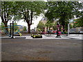
Adamsdown Play Centre
This modern outdoor children's play area contains a number of pieces of equipment you might expect to see in an air-conditioned gym, like weights machines and cross trainers.
Image: © Neil Owen
Taken: 16 Jul 2014
0.02 miles
2
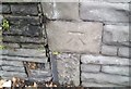
Ordnance Survey Cut Mark
This OS cut mark can be found on the SE face of No35 Howard Gardens. It marks a point 10.418m above mean sea level.
Image: © Adrian Dust
Taken: 1 Oct 2017
0.03 miles
3
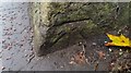
Ordnance Survey Cut Mark
This OS cut mark can be found on the SW face of the wall at the now blocked entrance to the Cemetery Park. It marks a point 10.013m above mean sea level.
Image: © Adrian Dust
Taken: 1 Oct 2017
0.05 miles
4
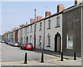
Augusta Street, Adamsdown, Cardiff
Houses on the SE side of the street, viewed from the Moira Place end. A row of black posts blocks off traffic from entering this end of Augusta Street. Vehicular access is from Meteor Street, at the far end of the street.
Image: © Jaggery
Taken: 3 Sep 2010
0.05 miles
5

A place called Nomad
Not inappropriately for a backpackers' hostel.
Image: © Neil Owen
Taken: 16 Jul 2014
0.07 miles
6
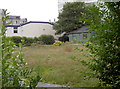
More than a length
This looks like an urban wild flower garden. It's not. Or at least, it wasn't until recently. This is in fact what has become of the Howard Gardens bowling green after it was closed by the council. Of particular note is the fact that this green was used by visually impaired bowlers, who are now left struggling to find another. See Image] for a look at the hut.
Image: © Neil Owen
Taken: 16 Jul 2014
0.07 miles
7

Ordnance Survey Cut Mark
This OS cut mark can be found on No22 Moira Terrace. It marks a point 10.183m above mean sea level.
Image: © Adrian Dust
Taken: 1 Oct 2017
0.08 miles
8
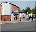
Adamsdown Post Office, Cardiff
Located at 11 Moira Place, inside McColl's Stores, previously a Londis store.
Image: © Jaggery
Taken: 3 Sep 2010
0.08 miles
9
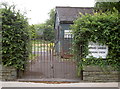
Howard Gardens Bowling Green
When the original plans were made to develop some of the Bute Estate a number of 'town square gardens' were included in them. Opened on December 28th, 1889, the gardens included a tennis court; by June 1914 this bowling green was declared open by the Lord Mayor. See Image] for a rather more pointed look at the building.
Image: © Neil Owen
Taken: 16 Jul 2014
0.08 miles
10
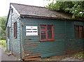
A hut left to the elements
Howard Gardens bowling green had been in use since before the First World War broke out. However, the local council has withdrawn its support and the club left locked out. See Image] for the state of the once lush green.
Image: © Neil Owen
Taken: 16 Jul 2014
0.08 miles