
IMAGES TAKEN NEAR TO
Scholars Drive, CARDIFF, CF23 9FE
Introduction
This page details the photographs taken nearby to Scholars Drive, CF23 9FE by members of the Geograph project.
The Geograph project started in 2005 with the aim of publishing, organising and preserving representative images for every square kilometre of Great Britain, Ireland and the Isle of Man.

There are currently over 7.5m images from over14,400 individuals and you can help contribute to the project by visiting https://www.geograph.org.uk
Image Map
Images are licensed for reuse under creativecommons.org/licenses/by-sa/2.0
Notes
- Clicking on the map will re-center to the selected point.
- The higher the marker number, the further away the image location is from the centre of the postcode.
Image Listing (18 Images Found)
Images are licensed for reuse under creativecommons.org/licenses/by-sa/2.0
Image
Details
Distance
1
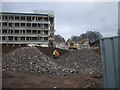
Demolishing a college, Colchester Ave, Cardiff
Image: © John Lord
Taken: 23 Feb 2012
0.03 miles
2
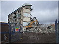
Demolition of a college, Colchester Ave, Cardiff
Image: © John Lord
Taken: 23 Feb 2012
0.03 miles
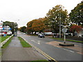
4
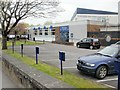
Celtic Suite restaurant, Colchester Avenue, Cardiff
Part of the UWIC (University of Wales Institute Cardiff) Colchester Avenue campus.
Image: © Jaggery
Taken: 14 Apr 2010
0.10 miles
5
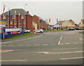
Ffordd Nowell, Colchester Avenue, Cardiff
Ffordd Nowell is a partly-completed Taylor Wimpey housing development on land on the south side of Colchester Avenue formerly occupied by business premises. Completion is expected in September 2010.
Ffordd Nowell is named after Gerald Nowell who has been a leading figure in the planning and layout of the nearby Howardian Local Nature Reserve.
Image: © Jaggery
Taken: 14 Apr 2010
0.12 miles
6
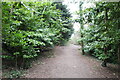
Path in Howardian Nature Reserve
Unfortunately leading nowhere as the access gate is locked!
Image: © John Light
Taken: 20 Mar 2021
0.15 miles
7
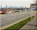
Lookers car dealership, Colchester Avenue, Cardiff
Peugeot and Alfa Romeo dealership.
Image: © Jaggery
Taken: 14 Apr 2010
0.15 miles
8
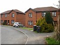
Howardian Close, Cardiff
Houses on the east side of the close, viewed from the Colchester Avenue end.
Image: © Jaggery
Taken: 14 Apr 2010
0.16 miles
9
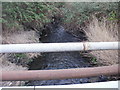
Roath Brook, Colchester Avenue, Cardiff
Roath Brook viewed from the north side of Colchester Avenue.
A few metres beyond the right edge of the photo is Roath Fire Station.http://www.geograph.org.uk/photo/1804513
Image: © Jaggery
Taken: 14 Apr 2010
0.16 miles
10
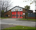
Roath Fire Station, Cardiff
Set back from the north side of Colchester Avenue. Located close to Newport Road and the Southern Way roundabout to help rapid response to callouts.
The twisted banner above the doors is only partly readable - the full message is something like
"Starting a fire could cost someone their life."
Image: © Jaggery
Taken: 14 Apr 2010
0.16 miles