IMAGES TAKEN NEAR TO
Allt Y Wennol, CARDIFF, CF23 8AS
Introduction
This page details the photographs taken nearby to Allt Y Wennol, CF23 8AS by members of the Geograph project.
The Geograph project started in 2005 with the aim of publishing, organising and preserving representative images for every square kilometre of Great Britain, Ireland and the Isle of Man.

There are currently over 7.5m images from over14,400 individuals and you can help contribute to the project by visiting https://www.geograph.org.uk
Image Map
Images are licensed for reuse under creativecommons.org/licenses/by-sa/2.0
Notes
- Clicking on the map will re-center to the selected point.
- The higher the marker number, the further away the image location is from the centre of the postcode.
Image Listing (11 Images Found)
Images are licensed for reuse under creativecommons.org/licenses/by-sa/2.0
Image
Details
Distance
3
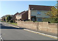
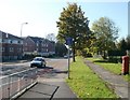
Almond Road, Cardiff
On the west side of Croescadarn Road, Almond Road leads to six other residential roads. This view is of the north side of the road, from near the corner of Croescadarn Road.
Image: © Jaggery
Taken: 11 Oct 2010
0.13 miles
4
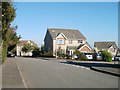
Naseby Close, Pontprennau, Cardiff
Houses on the corner of Naseby Close and Croescadarn Road.
Image: © Jaggery
Taken: 11 Oct 2010
0.19 miles
5
End of cycle route, Pentwyn Road, Cardiff
On the north side of Pentwyn Road, a white-on-blue rectangular sign announces the end of the cycle route on the right. A few metres ahead the route ends beside trees.
Image: © Jaggery
Taken: 11 Oct 2010
0.19 miles
6
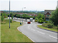
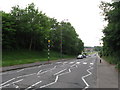
Heol Glandulais
This new road marks the Western Edge of the Pontprennau development. The large buildings near the horizon are the Avesta Steelworks; between them is the island of Steep Holm. On the left horizon is Brean Down in Somerset.
Image: © John Thorn
Taken: 30 Jun 2006
0.20 miles
8
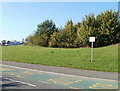
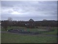
Please do not park on the grass, Pontprennau, Cardiff
A sign at the edge of open space on the north side of Heol Pontprennau states
PLEASE DO NOT PARK ON THE GRASS. CAR PARKING IS AVAILABLE AT THE COMMUNITY CENTRE.
The community centre's car park is little more than 100 metres to the east.
Image: © Jaggery
Taken: 11 Oct 2010
0.22 miles
10
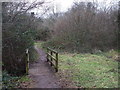
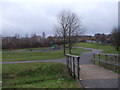
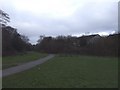
Footpath amongst bushes, Pentwyn, Cardiff
Image: © John Lord
Taken: 28 Jan 2010
0.23 miles