
IMAGES TAKEN NEAR TO
Lake Road West, CARDIFF, CF23 5QX
Introduction
This page details the photographs taken nearby to Lake Road West, CF23 5QX by members of the Geograph project.
The Geograph project started in 2005 with the aim of publishing, organising and preserving representative images for every square kilometre of Great Britain, Ireland and the Isle of Man.

There are currently over 7.5m images from over14,400 individuals and you can help contribute to the project by visiting https://www.geograph.org.uk
Image Map
Images are licensed for reuse under creativecommons.org/licenses/by-sa/2.0
Notes
- Clicking on the map will re-center to the selected point.
- The higher the marker number, the further away the image location is from the centre of the postcode.
Image Listing (114 Images Found)
Images are licensed for reuse under creativecommons.org/licenses/by-sa/2.0
Image
Details
Distance
1
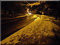
Lake Rd West, Cardiff, on a snowy November evening
Image: © John Lord
Taken: 26 Nov 2010
0.01 miles
3
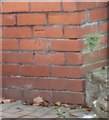
Ordnance Survey Cut Mark
This OS cut mark can be found on No199 Lake Road West. It marks a point 24.954m above mean sea level.
Image: © Adrian Dust
Taken: 19 Nov 2017
0.02 miles
4

Wild Gardens ahead, Cardiff
Ahead is an entrance from Lake Road West to Wild Gardens, the northern section of Roath Park.
Image: © Jaggery
Taken: 23 Aug 2010
0.04 miles
5
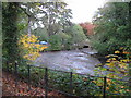
Roath Park Lake - drained!
The level of Roath Park Lake has been temporarily lowered to allow vegetation clearance around the edge and removal of rubbish. This is the exposed lake bed at the northern end.
Image: © Gareth James
Taken: 23 Oct 2009
0.05 miles
6
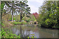
North end of Roath Park Lake - Cardiff
To the north of this end of the lake which is fed by the Nant Fawr and Llanishen Brook is a wild garden offering a contrast to the remaining complex of well maintained lake and parkland in the immediate area.
Image: © Mick Lobb
Taken: 28 Apr 2010
0.05 miles
7

Cardiff - Roath Park Lake
Perhaps one of Cardiff's most popular open spaces, Roath Park was built on 130 acres of bogland. The park now includes the 30 acre Roath Park Lake (1.3 miles circumference) which was formed by damming of the Nant Fawr stream.
www.cardiffparks.org.uk
Image: © Colin Smith
Taken: 10 Oct 2021
0.06 miles
8

Drake Tufted Duck Roath Park Lake - Cardiff
Image: © Mick Lobb
Taken: 28 Apr 2010
0.06 miles
9

Wild Gardens Road, Cardiff
Viewed from Lake Road West.
Wild Gardens Road connects Lake Road West with Lake Road East. Its course is between the northern edge of Roath Park Lake, and, on the left, the southern edge of Wild Gardens, the name given to the northernmost section of Roath Park.
Image: © Jaggery
Taken: 23 Aug 2010
0.07 miles
