
IMAGES TAKEN NEAR TO
Ty-Gwyn Road, CARDIFF, CF23 5QD
Introduction
This page details the photographs taken nearby to Ty-Gwyn Road, CF23 5QD by members of the Geograph project.
The Geograph project started in 2005 with the aim of publishing, organising and preserving representative images for every square kilometre of Great Britain, Ireland and the Isle of Man.

There are currently over 7.5m images from over14,400 individuals and you can help contribute to the project by visiting https://www.geograph.org.uk
Image Map
Images are licensed for reuse under creativecommons.org/licenses/by-sa/2.0
Notes
- Clicking on the map will re-center to the selected point.
- The higher the marker number, the further away the image location is from the centre of the postcode.
Image Listing (34 Images Found)
Images are licensed for reuse under creativecommons.org/licenses/by-sa/2.0
Image
Details
Distance
1
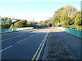
Cardiff : Ty Gwyn Road crosses above Eastern Avenue
The view south along the bridge carrying Ty Gwyn Road above Eastern Avenue (A48).
Image: © Jaggery
Taken: 11 Oct 2010
0.02 miles
3
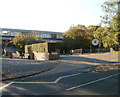
Entrance to St David's College, Cardiff
The entrance to St David's Catholic Sixth Form College is from Ty Gwyn Road, about 100 metres south of the bridge http://www.geograph.org.uk/photo/2116017 over Eastern Avenue (A48).
Image: © Jaggery
Taken: 11 Oct 2010
0.04 miles
4
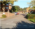
Glenside Court, Cardiff
Built in 1989, Glenside Court contains 52 flats. It is located on the eastern side of Ty Gwyn Road, just north of the bridge over Eastern Avenue (A48). There is a resident management staff and community alarm service. New residents must be at least 60 years old. Glenside Court consists of five buildings named Dyfed House, Powys House, Gwent House, Clwyd House and Gwynedd House.
Image: © Jaggery
Taken: 11 Oct 2010
0.08 miles
5
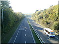
Cardiff : Eastern Avenue heading west
Viewed from Ty Gwyn Road bridge. Eastern Avenue (A48) heads in the direction of the Gabalfa Interchange, about 3 kilometres away.
Image: © Jaggery
Taken: 11 Oct 2010
0.12 miles
6
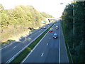
Cardiff : Eastern Avenue heading east
Viewed from Ty Gwyn Road bridge. Eastern Avenue (A48) heads towards the bridge carrying Bronwydd Avenue.
Image: © Jaggery
Taken: 11 Oct 2010
0.13 miles
7
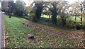
Footpath near Roath Park
Footpath alongside Ty Draw Road, Roath Park.
Image: © Alan Hughes
Taken: 1 Nov 2017
0.14 miles
8
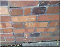
Ordnance Survey Cut Mark
This OS cut mark can be found on No28 Ty Draw Road. It marks a point 15.466m above mean sea level.
Image: © Adrian Dust
Taken: 19 Nov 2017
0.14 miles
9
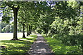
The pathway along the Northeastern edge of Roath Park Recreation ground
Image: © john bristow
Taken: 9 Jun 2012
0.16 miles
10
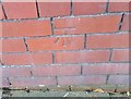
Ordnance Survey Cut Mark
This OS cut mark can be found on No9 Ty Draw Road. It marks a point 16.429m above mean sea level.
Image: © Adrian Dust
Taken: 19 Nov 2017
0.16 miles