
IMAGES TAKEN NEAR TO
Ty-Gwyn Road, CARDIFF, CF23 5JB
Introduction
This page details the photographs taken nearby to Ty-Gwyn Road, CF23 5JB by members of the Geograph project.
The Geograph project started in 2005 with the aim of publishing, organising and preserving representative images for every square kilometre of Great Britain, Ireland and the Isle of Man.

There are currently over 7.5m images from over14,400 individuals and you can help contribute to the project by visiting https://www.geograph.org.uk
Image Map
Images are licensed for reuse under creativecommons.org/licenses/by-sa/2.0
Notes
- Clicking on the map will re-center to the selected point.
- The higher the marker number, the further away the image location is from the centre of the postcode.
Image Listing (53 Images Found)
Images are licensed for reuse under creativecommons.org/licenses/by-sa/2.0
Image
Details
Distance
1
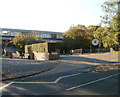
Entrance to St David's College, Cardiff
The entrance to St David's Catholic Sixth Form College is from Ty Gwyn Road, about 100 metres south of the bridge http://www.geograph.org.uk/photo/2116017 over Eastern Avenue (A48).
Image: © Jaggery
Taken: 11 Oct 2010
0.08 miles
2
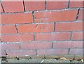
Ordnance Survey Cut Mark
This OS cut mark can be found on No9 Ty Draw Road. It marks a point 16.429m above mean sea level.
Image: © Adrian Dust
Taken: 19 Nov 2017
0.09 miles
3

The Tudors, Melrose Avenue, Penylan, Cardiff
Presumably the similarity of these modern houses to buildings from the Tudor period is limited to black stripes on a white background.
The Tudors are at 1-17 Melrose Avenue ; houses 18-43 are Melrose Gardens.
Image: © Jaggery
Taken: 14 Apr 2010
0.10 miles
4
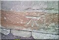
Ordnance Survey Cut Mark
This OS cut mark can be found on the SE parapet of the railway bridge. It marks a point 21.535m above mean sea level.
Image: © Adrian Dust
Taken: 19 Nov 2017
0.10 miles
5
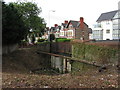
Former railway bridge, Roath
Land around the eastern side of the Pen-y-Lan Road bridge over the former Roath Docks Branch has recently been cleared of vegetation. A notice says the land is sold, so presumably this view will only be temporary!
Image: © Gareth James
Taken: 23 Aug 2012
0.11 miles
6
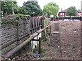
Former railway bridge, Roath
Land around the eastern side of the Pen-y-Lan Road bridge over the former Roath Docks Branch has recently been cleared of vegetation. A notice says the land is sold, so presumably this view will only be temporary!
Image: © Gareth James
Taken: 23 Aug 2012
0.11 miles
7
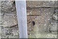
Ordnance Survey Cut Mark
This OS cut mark can be found on the wall SW side of Bronwydd Avenue. It marks a point 27.469m above mean sea level.
Image: © Adrian Dust
Taken: 19 Nov 2017
0.11 miles
8
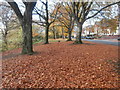
Fallen leaves beside Ty-Draw Rd, Cardiff
This stretch is a sort of extension of Roath Park, on the other side of Roath Brook from the recreation field.
Image: © John Lord
Taken: 12 Nov 2018
0.11 miles
9
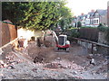
Development work in Pen-y-Lan
The last plot on the former Roath Docks Branch, next to Pen-y-Lan Road bridge, now appears to be under development. Older photos of the site, soon after it was sold and the land initially cleared are here:
Image
Image
Image: © Gareth James
Taken: 20 Aug 2013
0.11 miles
10
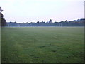
Roath Park Recreational Ground
Full of people in the Summer but where is everyone at ten to seven on a September morning ?
Image: © Steve Chapple
Taken: 13 Sep 2005
0.12 miles