IMAGES TAKEN NEAR TO
The Terrace, CARDIFF, CF15 9NG

Introduction

This page details the photographs taken nearby to The Terrace, CF15 9NG by members of the Geograph project.

The Geograph project started in 2005 with the aim of publishing, organising and preserving representative images for every square kilometre of Great Britain, Ireland and the Isle of Man.

There are currently over 7.5m images from over14,400 individuals and you can help contribute to the project by visiting https://www.geograph.org.uk

Image Map


Images are licensed for reuse under creativecommons.org/licenses/by-sa/2.0
Notes
  • Clicking on the map will re-center to the selected point.
  • The higher the marker number, the further away the image location is from the centre of the postcode.

Image Listing (51 Images Found)

Images are licensed for reuse under creativecommons.org/licenses/by-sa/2.0
  • ...
Image
Details
Distance
1
Football Terrace, Greigiau.
The row of houses in this image are called 'The Terrace' and would have backed onto the railway line prior to its demise.
Image: © Peter Wasp Taken: 4 Apr 2007
0.01 miles
2
Southern end of The Terrace, Creigiau
Viewed across Station Road. The Terrace http://www.geograph.org.uk/photo/5544028 leads to Castle Close.
Image: © Jaggery Taken: 19 Sep 2017
0.03 miles
3
The Terrace, Creigiau
From Station Road, The Terrace leads to Castle Close.
Image: © Jaggery Taken: 19 Sep 2017
0.03 miles
4
Old Station Yard, Creigiau
On the north side of Station Road, in 2017 Old Station Yard is the premises of Creigiau Travel Ltd. Old maps show that this was the location of Creigiau railway station and yard. Opened in 1896, Creigiau station was on the Barry Railway between Efail Isaf and Wenvoe. The railway ran roughly north-south through Creigiau. Passenger services here ended in 1962.
Image: © Jaggery Taken: 19 Sep 2017
0.04 miles
5
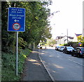
Pont wan 200 llath/Weak bridge 200 yds, Creigiau
The Welsh/English sign facing Cardiff Road show a 7.5 tonnes vehicle weight limit across a Station Road bridge 200 yards away.
Image: © Jaggery Taken: 19 Sep 2017
0.04 miles
6
Station Road, Creigiau
Viewed across Cardiff Road. Creigiau Inn http://www.geograph.org.uk/photo/5543326 is on the right. Station Road formerly led to Creigiau railway station which closed in 1962.
Image: © Jaggery Taken: 19 Sep 2017
0.05 miles
7
Station Road/Heol Creigiau junction
Image: © Colin Pyle Taken: 9 Sep 2011
0.05 miles
8
Pink house, Station Road, Creigiau
Image: © Jaggery Taken: 19 Sep 2017
0.05 miles
9
Barry Railway bridge Creigiau
Railway ran under the bridge into Creigiau station on the far side.
Image: © Ray Durrant Taken: 22 Apr 2010
0.05 miles
10
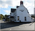
Creigiau Inn, Creigiau
In September 2017 the letter U is missing from the name on the west wall of the inn on the corner of Station Road and Cardiff Road.
Image: © Jaggery Taken: 19 Sep 2017
0.06 miles
  • ...