
IMAGES TAKEN NEAR TO
Gwaelod-y-Garth, CARDIFF, CF15 9JJ
Introduction
This page details the photographs taken nearby to CF15 9JJ by members of the Geograph project.
The Geograph project started in 2005 with the aim of publishing, organising and preserving representative images for every square kilometre of Great Britain, Ireland and the Isle of Man.

There are currently over 7.5m images from over14,400 individuals and you can help contribute to the project by visiting https://www.geograph.org.uk
Image Map
Images are licensed for reuse under creativecommons.org/licenses/by-sa/2.0
Notes
- Clicking on the map will re-center to the selected point.
- The higher the marker number, the further away the image location is from the centre of the postcode.
Image Listing (10 Images Found)
Images are licensed for reuse under creativecommons.org/licenses/by-sa/2.0
Image
Details
Distance
1
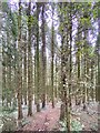
Vertical lines
Ideal for pit props, telephone poles and fencing posts.
Image: © Alan Hughes
Taken: 7 Sep 2020
0.15 miles
3
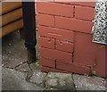
Ordnance Survey Cut Mark
This OS cut mark can be found on No51 Oxford Street. It marks a point 36.692m above mean sea level.
Image: © Adrian Dust
Taken: 17 Aug 2019
0.19 miles
4
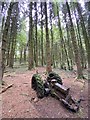
Abandoned tractor
Tractor abandoned in Coed y Gedrys.
Image: © Alan Hughes
Taken: 7 Sep 2020
0.19 miles
5
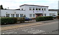
Learning Curve, Nantgarw
Opened in 2011, this is Rhondda Cynon Taf Council's Learning Curve Skills For Independence Day Service which is aimed at improving opportunities for adults with learning disabilities.
Image: © Jaggery
Taken: 6 Jan 2012
0.22 miles
6
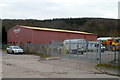
Derwen Tooling Ltd, Treforest Industrial Estate
Located at the southern end of The Willowford, on a bank of the River Taff.
Derwen Tooling supplies a range of products to the toolmaking industry. Products include pillars & bushes, die sets, die springs, gas springs and Urelast bars & springs. Urelast is a brand name for a type of polyurethane elastomer, a polymer with great resistance to abrasion and solvents.
Image: © Jaggery
Taken: 6 Jan 2012
0.22 miles
7
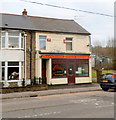
Chan's Chinese Kitchen, Nantgarw
Chinese takeaway at 1 Oxford Street.
Image: © Jaggery
Taken: 6 Jan 2012
0.23 miles
8
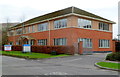
Albion House, Oxford Street, Nantgarw
Modern office block alongside the A4054. An estate agents' board shows that one of the office suites was available to let at the early January 2012 date of this view.
Image: © Jaggery
Taken: 6 Jan 2012
0.23 miles
9
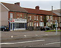
Mobile Money, Nantgarw
The business is at 111 Oxford Street.
Cash loans are available using their Logbook Loan, where loans are secured on a car that is clear of any outstanding finance. Their website shows that such loans have an extremely high rate of interest.
For example, a cash loan of £800 is repayable in 18 monthly instalments of £134.11, a total of £2413.98, plus a £30 document registration fee. The representative APR is shown as 464.4%.
Image: © Jaggery
Taken: 6 Jan 2012
0.25 miles
10
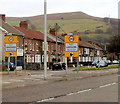
Nantgarw boundary
The A4054 reaches the Nantgarw boundary.
Behind the camera are Parc Nantgarw and Treforest Industrial Estate.
Image: © Jaggery
Taken: 6 Jan 2012
0.25 miles