1
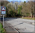
Fence view of Tafarn Tŷ Nant, Morganstown, Cardiff
Brains Brewery pub opposite the junction of the B4262 Ty-Nant Road and Ffordd Treforgan.
Image: © Jaggery
Taken: 3 Mar 2015
0.01 miles
2
Tafarn Tŷ Nant, Morganstown, Cardiff
Brains Brewery pub opposite the junction of the B4262 Ty-Nant Road and Ffordd Treforgan.
Image: © Jaggery
Taken: 3 Mar 2015
0.01 miles
3
Dark green gas installation, Morganstown, Cardiff
The Wales & West Utilities gas installation is opposite the junction
of Ffordd Treforgan and the B4262 Ty-Nant Road, near Tafarn Tŷ Nant. http://www.geograph.org.uk/photo/4402705
Image: © Jaggery
Taken: 3 Mar 2015
0.03 miles
4
Humps for half a mile ahead on Ffordd Treforgan, Morganstown, Cardiff
The sign is at the corner of the B4262 Ty-Nant Road.
Image: © Jaggery
Taken: 3 Mar 2015
0.05 miles
5
Morganstown Village Millennium Stone, Cardiff
Located on top of a mound at the corner of Ffordd Treforgan and the B4262 Ty-Nant Road,
the stone records that the population of Morganstown was 1500 on March 5th 2000.
Image: © Jaggery
Taken: 3 Mar 2015
0.05 miles
6
Bench and Millennium Stone, Morganstown, Cardiff
On top of a mound at the corner of Ffordd Treforgan and the B4262 Ty-Nant Road.
http://www.geograph.org.uk/photo/4402759 to a closer view of the stone.
Image: © Jaggery
Taken: 3 Mar 2015
0.05 miles
7
Ty-Nant Road pelican crossing, Morganstown, Cardiff
Across the B4262 Ty-Nant Road near the Ffordd Treforgan junction (ahead).
Chambers Dictionary states that "pelican" is adapted from "pedestrian light controlled crossing".
Image: © Jaggery
Taken: 3 Mar 2015
0.05 miles
8
Hillside car park, Morganstown, Cardiff
The Tafarn Tŷ Nant http://www.geograph.org.uk/photo/4402705 car park on the north side of Ffordd Treforgan.
Image: © Jaggery
Taken: 3 Mar 2015
0.05 miles
9
Start of the 30 zone at the northern edge of Morganstown, Cardiff
The 40mph speed limit along Ty-Nant Road drops to 30 at the edge of Morganstown (Treforgan in Welsh).
Small circular signs show a 7.5 tonnes vehicle weight limit.
Image: © Jaggery
Taken: 3 Mar 2015
0.06 miles
10
The Ty Nant Inn, Morganstown
Image: © John Lord
Taken: 22 May 2010
0.06 miles


