1
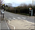
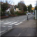
Zebra crossing and speed camera near Radyr Comprehensive School, Cardiff
The road is the B4262 Heol Isaf.
Image: © Jaggery
Taken: 5 Mar 2015
0.06 miles
2
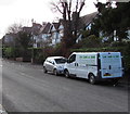
Loc Lam & Son van, Heol Isaf, Radyr, Cardiff
Text on the Renault van includes The Gardener of Radyr
Green Lawns ● Healthy Trees ● Shrubs ● Hedges ● Weed Control.
Image: © Jaggery
Taken: 26 Jan 2018
0.06 miles
3
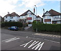
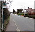
Houses opposite the entrance to Radyr Comprehensive School, Cardiff
On the west side of the B4262 Heol Isaf in the Radyr area of Cardiff.
Image: © Jaggery
Taken: 26 Jan 2018
0.07 miles
4
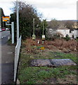
Wales & West Utilities gas installation, Radyr, Cardiff
On the east side of the B4262 Heol Isaf near a speed camera and zebra crossing.
Image: © Jaggery
Taken: 26 Jan 2018
0.07 miles
5
Zebra crossing and speed camera, Heol Isaf, Radyr, Cardiff
The entrance to Radyr Comprehensive School from the B4262 Heol Isaf is behind the camera.
Image: © Jaggery
Taken: 26 Jan 2018
0.07 miles
6
Evergreen tree on the west side of the B4262 Heol Isaf, Radyr, Cardiff
Viewed on January 26th 2018.
Image: © Jaggery
Taken: 26 Jan 2018
0.07 miles
7
Way in to Radyr Comprehensive School, Cardiff
From the B4262 Heol Isaf. Entrance only - the exit road http://www.geograph.org.uk/photo/4372923 is 80 metres to the south.
Image: © Jaggery
Taken: 5 Mar 2015
0.08 miles
8
Lime Close, Radyr, Cardiff
Cul-de-sac accessed from Woodfield Avenue.
Image: © Jaggery
Taken: 5 Mar 2015
0.08 miles
9
Comprehensive School bus stop sign, Radyr, Cardiff
The sign is alongside the B4262 Heol Isaf near Radyr Comprehensive School. The sign shows three bus route numbers, though I do not know whether or not the buses shown pass this way in March 2015.
In this area, bus stops and notices are the responsibility of the local council, not the bus companies. Timetables are sometimes out of date, or some routes shown have ceased to operate. I recently heard an account from Torfaen that bus stop signs were erected along a planned bus route in Cwmbran. The plans were scrapped before the service began, but the bus stop signs remain in place...
Image: © Jaggery
Taken: 5 Mar 2015
0.08 miles
10
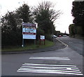
Radyr Comprehensive School nameboards alongside the B4262, Cardiff
The larger board shows that Radyr Comprehensive School is Ysgol Gyfun Radur in Welsh.
Image: © Jaggery
Taken: 26 Jan 2018
0.08 miles


