IMAGES TAKEN NEAR TO
Wenallt Road, CARDIFF, CF14 6TQ
Introduction
This page details the photographs taken nearby to Wenallt Road, CF14 6TQ by members of the Geograph project.
The Geograph project started in 2005 with the aim of publishing, organising and preserving representative images for every square kilometre of Great Britain, Ireland and the Isle of Man.

There are currently over 7.5m images from over14,400 individuals and you can help contribute to the project by visiting https://www.geograph.org.uk
Image Map
Images are licensed for reuse under creativecommons.org/licenses/by-sa/2.0
Notes
- Clicking on the map will re-center to the selected point.
- The higher the marker number, the further away the image location is from the centre of the postcode.
Image Listing (18 Images Found)
Images are licensed for reuse under creativecommons.org/licenses/by-sa/2.0
Image
Details
Distance
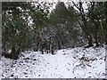
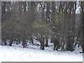
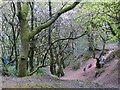
3
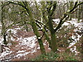
Coed y Wenallt
Looking down from the earthworks.
Image: © Gareth James
Taken: 8 Feb 2009
0.13 miles
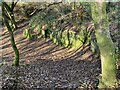
4
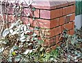
Ordnance Survey Cut Mark
This OS cut mark can be found on the small reservoir building SW side of Wenallt Road. It marks a point 89.395m above mean sea level.
Image: © Adrian Dust
Taken: 26 Feb 2024
0.13 miles
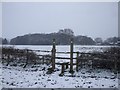
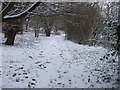
9
Coed y Wenallt, Cardiff
Children playing on a rope swing.
Coed y Wenallt is a designated ancient woodland on a red sandstone ridge to the north of Cardiff.
Image: © Robin Drayton
Taken: 29 Apr 2017
0.19 miles
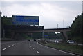
10
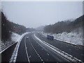
The M4, looking west from Wenallt Road, Cardiff
Image: © John Lord
Taken: 5 Feb 2009
0.20 miles