
IMAGES TAKEN NEAR TO
Tatham Road, CARDIFF, CF14 5FG
Introduction
This page details the photographs taken nearby to Tatham Road, CF14 5FG by members of the Geograph project.
The Geograph project started in 2005 with the aim of publishing, organising and preserving representative images for every square kilometre of Great Britain, Ireland and the Isle of Man.

There are currently over 7.5m images from over14,400 individuals and you can help contribute to the project by visiting https://www.geograph.org.uk
Image Map
Images are licensed for reuse under creativecommons.org/licenses/by-sa/2.0
Notes
- Clicking on the map will re-center to the selected point.
- The higher the marker number, the further away the image location is from the centre of the postcode.
Image Listing (155 Images Found)
Images are licensed for reuse under creativecommons.org/licenses/by-sa/2.0
Image
Details
Distance
2
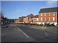
Caerphilly Rd, Cardiff
The apartments on the right are built on the site of the former Royal Ordnance Factory. Towards the end of its existence, this factory made parts for missiles, and so was the occasional scene of anti-nuclear demonstrations. The hill in the distance is Graig Llanishen, on which are the ruins of Castell Morgraig. On the right of the picture can be seen part of the name of the side street, Ffordd Morgraig, presumably named after Castell Morgraig ImageThe road sign actually says Ffordd Mograig, but this is surely a typo.
Image: © John Lord
Taken: 4 Mar 2010
0.12 miles
3
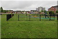
Children's play area north of Smith Road, Cardiff
Opposite Llys Enfys. http://www.geograph.org.uk/photo/5011044
Image: © Jaggery
Taken: 21 Jun 2016
0.12 miles
4
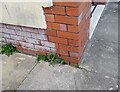
Ordnance Survey Cut Mark
This OS cut mark can be found on No455 Caerphilly Road. It marks a point 41.742m above mean sea level.
Image: © Adrian Dust
Taken: 26 Feb 2024
0.13 miles
5
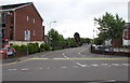
Junction at the western end of Smith Road, Cardiff
Smith Road leads to Pentland Close. Except for buses, Smith Road is not a through route for motor vehicles.
Image: © Jaggery
Taken: 21 Jun 2016
0.14 miles
6
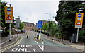
Warning signs - rising bollards, Malvern Drive, Cardiff
On the approach to Smith Road.
Image: © Jaggery
Taken: 21 Jun 2016
0.15 miles
7
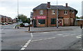
Former Thresher off-licence, Caerphilly Road, Cardiff
Vacant premises at 493 Caerphilly Road, on the corner of Beulah Road.
Nationwide, more than a thousand Thresher off-licence stores closed at the end of 2009, with the loss of several thousand jobs, after the company entered administration.
Image: © Jaggery
Taken: 12 Aug 2010
0.15 miles
8
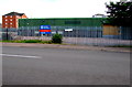
Industrial building to let or for sale, Malvern Drive, Cardiff
The 60 metre long building is on the corner of Malvern Drive and Ashbourn Way, viewed in June 2016.
Image: © Jaggery
Taken: 21 Jun 2016
0.15 miles
9
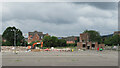
Demolition of the former tax office in Llanishen
Image: © Gareth James
Taken: 1 Jul 2023
0.15 miles
10
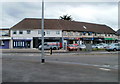
Beulah Road shops, Cardiff
Shops and other business premises arranged in an arc at the eastern end of Beulah Road, opposite the mini-roundabout on the A469 where the northern end of Caerphilly Road becomes the southern end of Thornhill Road.
Image: © Jaggery
Taken: 12 Aug 2010
0.16 miles