
IMAGES TAKEN NEAR TO
Cae Yorath, CARDIFF, CF14 1QA
Introduction
This page details the photographs taken nearby to Cae Yorath, CF14 1QA by members of the Geograph project.
The Geograph project started in 2005 with the aim of publishing, organising and preserving representative images for every square kilometre of Great Britain, Ireland and the Isle of Man.

There are currently over 7.5m images from over14,400 individuals and you can help contribute to the project by visiting https://www.geograph.org.uk
Image Map
Images are licensed for reuse under creativecommons.org/licenses/by-sa/2.0
Notes
- Clicking on the map will re-center to the selected point.
- The higher the marker number, the further away the image location is from the centre of the postcode.
Image Listing (29 Images Found)
Images are licensed for reuse under creativecommons.org/licenses/by-sa/2.0
Image
Details
Distance
1
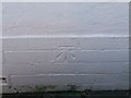
Ordnance Survey Cut Mark
This OS cut mark can be found on No29 Cae Gwyn Road. It marks a point 35.421m above mean sea level.
Image: © Adrian Dust
Taken: 18 Nov 2018
0.14 miles
2
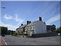
Junction of Merthyr Rd and Mervyn Rd, Whitchurch, Cardiff
Image: © John Lord
Taken: 30 May 2010
0.16 miles
3
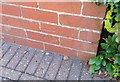
Ordnance Survey Cut Mark
This OS cut mark can be found on No3 Greenclose Road. It marks a point 31.751m above mean sea level.
Image: © Adrian Dust
Taken: 18 Nov 2018
0.17 miles
4
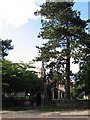
Ararat English Baptist church, Whitchurch, Cardiff
Image: © Gareth James
Taken: 5 Jul 2010
0.17 miles
5
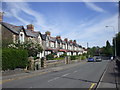
Merthyr Rd, Whitchurch, Cardiff
The wall on the far right runs along the bank of a brook.
Image: © John Lord
Taken: 30 May 2010
0.17 miles
6
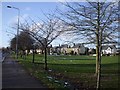
Whitchurch Common, Cardiff
This is the smaller part of the common, north of Merthyr Rd
Image: © John Lord
Taken: 3 Feb 2009
0.18 miles
7
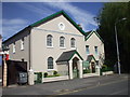
The Tabernacle, Presbyterian Church of Wales, Whitchurch, Cardiff
Image: © John Lord
Taken: 30 May 2010
0.18 miles
8
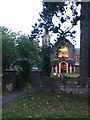
Ararat English Baptist Church, Whitchurch
Designed by William Beddoes Rees who was also a Liberal politician, who represented Bristol South in Parliament.
Image: © Eirian Evans
Taken: 16 Jul 2010
0.19 miles
9
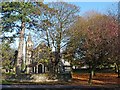
Ararat Baptist Church, Merthyr Road, Whitchurch
The church is named after Mount Ararat in eastern Turkey which according to the Bible was the resting place of Noah's ark.
This seems to be the only use of this name for a church in the UK.
Image: © Robin Drayton
Taken: 17 Nov 2011
0.19 miles
10
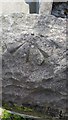
Ordnance Survey Rivet
This OS rivet can be found on the wall SW side of Merthyr Road. It marks a point 26.819m above mean sea level.
Image: © Adrian Dust
Taken: 28 Oct 2019
0.19 miles