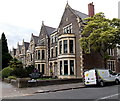
IMAGES TAKEN NEAR TO
Dyfrig Street, CARDIFF, CF11 9LR

Introduction

This page details the photographs taken nearby to Dyfrig Street, CF11 9LR by members of the Geograph project.

The Geograph project started in 2005 with the aim of publishing, organising and preserving representative images for every square kilometre of Great Britain, Ireland and the Isle of Man.

There are currently over 7.5m images from over14,400 individuals and you can help contribute to the project by visiting https://www.geograph.org.uk

Image Map


Images are licensed for reuse under creativecommons.org/licenses/by-sa/2.0
Notes
  • Clicking on the map will re-center to the selected point.
  • The higher the marker number, the further away the image location is from the centre of the postcode.

Image Listing (101 Images Found)

Images are licensed for reuse under creativecommons.org/licenses/by-sa/2.0
  • ...
Image
Details
Distance
1
Dyfrig Street, Cardiff
Looking NE from Cathedral Road.
Image: © Jaggery Taken: 26 May 2014
0.02 miles
2
Lincoln House Hotel, Cardiff
On the corner of Cathedral Road and Dyfrig Street.
Image: © Jaggery Taken: 26 May 2014
0.04 miles
3
Potentially lethal gate in Kyveilog Street, Cardiff
Warning notices http://www.geograph.org.uk/photo/4079163 on the wall on each side of the gate explain the potential danger.
Image: © Jaggery Taken: 26 May 2014
0.04 miles
4
Moving gate warning notice in Kyveilog Street, Cardiff
This is one of two identical warnings alongside this http://www.geograph.org.uk/photo/4079159 gate.
Image: © Jaggery Taken: 26 May 2014
0.04 miles
5
Kyveilog Street, Cardiff
Looking towards the NE end of the street. Cathedral Road is 50 metres behind the camera. The spelling Kyveilog looks like a 19th century Anglicisation of a Welsh place name, perhaps Caefaelog or similar.
Image: © Jaggery Taken: 26 May 2014
0.05 miles
6
Ordnance Survey Cut Mark
This OS cut mark can be found on No15 Kyveilog Road. It marks a point 10.147m above mean sea level.
Image: © Adrian Dust Taken: 15 Oct 2017
0.05 miles
7
Ordnance Survey Cut Mark
This OS cut mark can be found on No15 Kyveilog Street. It marks a point 33.27ft above mean sea level.
Image: © Adrian Dust Taken: 23 Sep 2021
0.05 miles
8
Unsatisfactory depiction of blind people, Cardiff
The road sign is alongside Cathedral Road near the Kyveilog Street junction. A standard sign for elderly people has been used, with changed wording.
Image: © Jaggery Taken: 26 May 2014
0.06 miles
9
Ordnance Survey Cut Mark
This OS cut mark can be found on the wall post of No123 Cathedral Road. It marks a point 9.165m above mean sea level.
Image: © Adrian Dust Taken: 15 Oct 2017
0.06 miles
10
Cardiff Camping and Caravan Site
Centrally situated, near Sofia Gardens and Pontcanna Fields
Image: © Eirian Evans Taken: 25 May 2021
0.08 miles
  • ...