IMAGES TAKEN NEAR TO
Leckwith Mews, CARDIFF, CF11 8HX

Introduction

This page details the photographs taken nearby to Leckwith Mews, CF11 8HX by members of the Geograph project.

The Geograph project started in 2005 with the aim of publishing, organising and preserving representative images for every square kilometre of Great Britain, Ireland and the Isle of Man.

There are currently over 7.5m images from over14,400 individuals and you can help contribute to the project by visiting https://www.geograph.org.uk

Image Map


Images are licensed for reuse under creativecommons.org/licenses/by-sa/2.0
Notes
  • Clicking on the map will re-center to the selected point.
  • The higher the marker number, the further away the image location is from the centre of the postcode.

Image Listing (78 Images Found)

Images are licensed for reuse under creativecommons.org/licenses/by-sa/2.0
  • ...
Image
Details
Distance
1
House, Leckwith Avenue
Image: © N Chadwick Taken: 29 May 2022
0.00 miles
2
Coal train near Ninian Park
Freightliner's class 66 locomotive No. 66563 approaches Ninian Park station with a loaded working from Tower Colliery to Aberthaw Power Station.
Image: © Gareth James Taken: 5 Nov 2016
0.03 miles
3
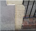
Ordnance Survey Cut Mark
This OS cut mark can be found on the wall NW side of Bassett Street. It marks a point 8.126m above mean sea level.
Image: © Adrian Dust Taken: 23 Sep 2021
0.08 miles
4
Ordnance Survey Cut Mark
This OS cut mark can be found on No51 Theobald Road. It marks a point 8.705m above mean sea level.
Image: © Adrian Dust Taken: 23 Sep 2021
0.09 miles
5
Coal train near Ninian Park
Freightliner's class 66 locomotive No. 66563 approaches Ninian Park station with a loaded working from Tower Colliery to Aberthaw Power Station.
Image: © Gareth James Taken: 5 Nov 2016
0.10 miles
6
The Lansdowne Hotel, Cardiff
On the corner of Beda Rd and the major road Lansdowne Rd. Road and pub are presumably named after the Marquess of Lansdowne, a prominent politician of the late C19th and early C20th. At the time the pub was built, 1898, he was Secretary of State for War, having previously been Governor General of Canada, then Viceroy of India. What the significance of the beehive/skep sign is, I don't know.
Image: © John Lord Taken: 1 Aug 2010
0.10 miles
7
Ordnance Survey Cut Mark
This OS cut mark can be found on No58 Denton Road. It marks a point 8.092m above mean sea level.
Image: © Adrian Dust Taken: 23 Sep 2021
0.12 miles
8
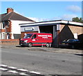
Darlington Bros premises and van, Broad Street, Leckwith, Cardiff
Roofing specialists.
Image: © Jaggery Taken: 14 Sep 2017
0.12 miles
9
Cumberland St, Cardiff
Image: © John Lord Taken: 1 Aug 2010
0.13 miles
10
Canton: Lansdowne Road at sunset
Towards the end of a sultry day in July.
Image: © John Sutton Taken: 12 Jul 2022
0.14 miles
  • ...