1
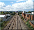
South Wales main line, Ely, Cardiff
Viewed from the bridge adjacent to the roundabout at which Cowbridge Road East meets Cowbridge Road West (and at which Western Avenue enters from the north).
Next station is this direction is Cardiff Central.
The white premises on the left are a Floors-2-Go warehouse.
On the right is an extensive area of wasteland, part of which was formerly occupied by Ely Paper Mill.
Image: © Jaggery
Taken: 22 Jul 2010
0.03 miles
2
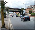
SA Best Bitter Bridge, Cowbridge Road East, Cardiff
The view from the NW shows bridge advertising for a famous product of local brewers Brains.
The other side of the bridge http://www.geograph.org.uk/photo/1982475 advertises a different product, now owned by Brains.
The railway bridge is close to Waun-gron Park station.
Image: © Jaggery
Taken: 22 Jul 2010
0.04 miles
3
Hancocks Beers bridge, Cowbridge Road East, Cardiff
The advertising on the SE side of the bridge is for Hancocks Beer. Formerly a separate company, Hancocks was bought by Bass in 1968. Bass sold Hancocks to Cardiff brewers Brains in 1999. The other side of the bridge advertises Brains SA. http://www.geograph.org.uk/photo/1982486
The railway bridge is close to Waun-gron Park station.
Image: © Jaggery
Taken: 22 Jul 2010
0.04 miles
4
Ty-Pwll Coch pub, Victoria Park, Cardiff
Pub located on the corner of Cowbridge Road East and Windway Road. Probably more than a century old, but looking more recent because of its mock-Tudor appearance, dating from the 1930s.
Image: © Jaggery
Taken: 22 Jul 2010
0.04 miles
5
One railway bridge viewed from another, Victoria Park, Cardiff
The bridge on which the photographer is standing is near the south side of Cowbridge Road East, adjacent to the Mayfield Avenue junction. The bridge in the distance carries the track heading for Waun-gron Park station across the South Wales main line, which is heading away from Cardiff Central towards Pontyclun station, about 15 kilometres distant.
Image: © Jaggery
Taken: 22 Jul 2010
0.04 miles
6
National Tyres and Autocare, Cardiff
The premises are located on the corner of Cowbridge Road East and Aldsworth Road, with a colour scheme some would describe as 'loud'. Services and products available include MoT test centre, tyres, exhausts, batteries, steering, brakes and suspension.
Image: © Jaggery
Taken: 22 Jul 2010
0.06 miles
7
River Ely, west of Cardiff
The River Ely is one of three that flow into the Severn at Cardiff (the others are the Taff and the Rhymney). The railway line in the foreground is the main Cardiff -Swansea line; the concreted area on the left is the remains of the Arjo Wiggins paper mill.
Image: © John Thorn
Taken: 23 Nov 2006
0.08 miles
8
South Wales Main Line, near Ely, Cardiff
Image: © Gareth James
Taken: 20 Jun 2010
0.08 miles
9
Birchfield Crescent, Cardiff
Image: © John Lord
Taken: 6 Aug 2010
0.08 miles
10
Ordnance Survey Cut Mark
This OS cut mark can be found on No11 Windway Road. It marks a point 8.684m above mean sea level.
Image: © Adrian Dust
Taken: 23 Sep 2021
0.09 miles


