IMAGES TAKEN NEAR TO
Withersfield Road, HAVERHILL, CB9 7RW
Introduction
This page details the photographs taken nearby to Withersfield Road, CB9 7RW by members of the Geograph project.
The Geograph project started in 2005 with the aim of publishing, organising and preserving representative images for every square kilometre of Great Britain, Ireland and the Isle of Man.

There are currently over 7.5m images from over14,400 individuals and you can help contribute to the project by visiting https://www.geograph.org.uk
Image Map
Images are licensed for reuse under creativecommons.org/licenses/by-sa/2.0
Notes
- Clicking on the map will re-center to the selected point.
- The higher the marker number, the further away the image location is from the centre of the postcode.
Image Listing (20 Images Found)
Images are licensed for reuse under creativecommons.org/licenses/by-sa/2.0
Image
Details
Distance
1
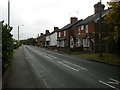
Withersfield Road
The nearest house bears the date 1902. Those which follow have name signs Woodbine Villas, Alpha Villas, Hawthorn Villas and Eglantine Villas, with dates 1877-1884.
Image: © Keith Edkins
Taken: 15 Nov 2017
0.01 miles
2
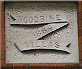
Withersfield Road (detail)
Houses 2 to 5 in Image all have date and date plaques in this pattern. This one is on house 2.
Image: © Keith Edkins
Taken: 15 Nov 2017
0.01 miles
3
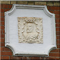
Withersfield Road (detail)
The first house in Image bears the date 1902 and what I take to be a patriotic portrait of the new King, Edward VII.
Image: © Keith Edkins
Taken: 15 Nov 2017
0.02 miles
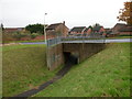
4
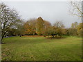
Green space at Howe Road
Between Withersfield Road and the Stour Brook
Image: © Keith Edkins
Taken: 15 Nov 2017
0.14 miles
5
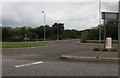
Roundabout on Withersfield Road, Haverhill
Image: © David Howard
Taken: 23 Aug 2020
0.15 miles
6
The A1307, Haverhill
Looking towards an impressive electricity transformer
Image: © David Howard
Taken: 23 Aug 2020
0.16 miles
7
Pedestrian underpass, Spindle Road
Underpasses like this are quite a feature of Haverhill
Image: © Keith Edkins
Taken: 15 Nov 2017
0.17 miles
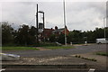
8
The end of the road from Withersfield
Image: © Robert Edwards
Taken: 12 Jan 2007
0.19 miles
9
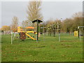
Playground, Howe Road
On the green space north of Stour Brook
Image: © Keith Edkins
Taken: 15 Nov 2017
0.19 miles
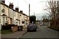
10
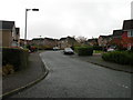
Gainsborough Road
1990s housing in north Haverhill
Image: © Keith Edkins
Taken: 15 Nov 2017
0.19 miles