IMAGES TAKEN NEAR TO
Reynolds Close, HAVERHILL, CB9 7FF

Introduction

This page details the photographs taken nearby to Reynolds Close, CB9 7FF by members of the Geograph project.

The Geograph project started in 2005 with the aim of publishing, organising and preserving representative images for every square kilometre of Great Britain, Ireland and the Isle of Man.

There are currently over 7.5m images from over14,400 individuals and you can help contribute to the project by visiting https://www.geograph.org.uk

Image Map


Images are licensed for reuse under creativecommons.org/licenses/by-sa/2.0
Notes
  • Clicking on the map will re-center to the selected point.
  • The higher the marker number, the further away the image location is from the centre of the postcode.

Image Listing (18 Images Found)

Images are licensed for reuse under creativecommons.org/licenses/by-sa/2.0
Image
Details
Distance
1
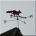
Weather vane, Hawthorn Road
"The fox gives warning It's a cold and frosty morning" - but it was actually quite mild for November
Image: © Keith Edkins Taken: 15 Nov 2017
0.04 miles
2
Gainsborough Road
1990s housing in north Haverhill
Image: © Keith Edkins Taken: 15 Nov 2017
0.05 miles
3
Part of a retail park at Haverhill
Image: © Adrian S Pye Taken: 3 Feb 2011
0.08 miles
4
Mini Roundabout
Mini roundabout at the bottom of Park Road, Haverhill, Suffolk.
Image: © Keith Evans Taken: 15 Mar 2012
0.12 miles
5
B & Q, Haverhill
Just off the A1307
Image: © Keith Edkins Taken: 15 Nov 2017
0.13 miles
6
B&Q Haverhill
Replacing Focus and Carpet Right, see Image Halfords is still there.
Image: © Hugh Venables Taken: 2 Apr 2015
0.14 miles
7
The A1307, Haverhill
Looking towards an impressive electricity transformer
Image: © David Howard Taken: 23 Aug 2020
0.14 miles
8
The end of the road from Withersfield
Image: © Robert Edwards Taken: 12 Jan 2007
0.16 miles
9
Approach Cottages, Bridge Approach
This terrace is in Withersfield parish but is on the edge of Haverhill some way from Withersfield village itself. The cottages first appear on OS maps in 1903, and at that time they had a railway line at the back and a brick works on the far end. The bridge in question, over the Stour Brook, is called Meldham Bridge on large scale maps. The lamp type post box is CB9 49.
Image: © Keith Edkins Taken: 15 Nov 2017
0.17 miles
10
Roundabout on Withersfield Road, Haverhill
Image: © David Howard Taken: 23 Aug 2020
0.18 miles