
IMAGES TAKEN NEAR TO
Norwich Road, NEWMARKET, CB8 7DD
Introduction
This page details the photographs taken nearby to Norwich Road, CB8 7DD by members of the Geograph project.
The Geograph project started in 2005 with the aim of publishing, organising and preserving representative images for every square kilometre of Great Britain, Ireland and the Isle of Man.

There are currently over 7.5m images from over14,400 individuals and you can help contribute to the project by visiting https://www.geograph.org.uk
Image Map
Images are licensed for reuse under creativecommons.org/licenses/by-sa/2.0
Notes
- Clicking on the map will re-center to the selected point.
- The higher the marker number, the further away the image location is from the centre of the postcode.
Image Listing (19 Images Found)
Images are licensed for reuse under creativecommons.org/licenses/by-sa/2.0
Image
Details
Distance
1
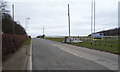
Entering Cambridgeshire
Heading north east on Bury Road (A1304).
Image: © JThomas
Taken: 19 Mar 2016
0.02 miles
2
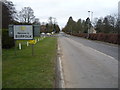
Entering Suffolk
Heading south west on the A1304.
Image: © JThomas
Taken: 19 Mar 2016
0.02 miles
3
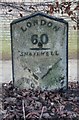
Old Milepost by the A1304 in Newmarket
Cast iron post by the A1304, in parish of Snailwell (East Cambridgeshire District), Bury Road, at junction with the B1506, opposite The Jockey Club Estates, Bury Side Depot, in hedge, on North side of road. Erected by the Bury St Edmunds & Newmarket turnpike trust in the 19th century. Possibly lost.
Opposite: SU_NMBU01 Image
Inscription reads:-
: THETFORD / 18 : : LONDON / 60 / SNAILWELL : : NEWMARKET / 1 :
Suffolk HER.
HER Number (Pref. Ref.): NKT 040 https://www.heritagegateway.org.uk/Gateway/Results_Single.aspx?uid=MSF25792&resourceID=1017
Milestone Society National ID: CA_LN60
Image: © MW Hallett
Taken: 29 Aug 2004
0.07 miles
4
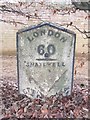
Old Milestone
Old milepost at Newmarket, Suffolk on what was the A.11. For overall view see http://www.geograph.org.uk/photo/2807441
Image: © Keith Evans
Taken: 16 Feb 2012
0.07 miles
5
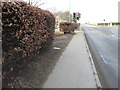
Old Milepost
Old milepost hidden in the hedge on the left at Newmarket, Suffolk on what was the A.11. For close up view see http://www.geograph.org.uk/photo/2807435
Image: © Keith Evans
Taken: 16 Feb 2012
0.07 miles
6
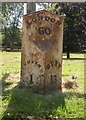
Old Milestone by the A1304, Bury Road, Newmarket Parish
Metal plate attached to stone post by the A1304, in parish of NEWMARKET (FOREST HEATH District), The Limekilns, Bury Road (note this is actually in Snailwell Parish, Cambs), on deep verge, on East side of road. Ridley iron casting, erected by the Bury St Edmunds & Newmarket turnpike trust in the 19th century.
Inscription reads:- : NEWMARKET / 1 : : LONDON / 60 : : BURY / 13 : : SAMUEL RIDLEY / IRON FOUNDER / ST EDMUNDS / BURY / 1838. :
Milestone Society National ID: SU_NMBU01.
Image: © R Mudhar & M Faherty
Taken: 7 Aug 2007
0.07 miles
7
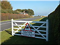
Racehorses crossing please give way
Crossing point between training grounds near The Lodge, Newmarket
Image: © Richard Humphrey
Taken: 28 Oct 2011
0.09 miles
8
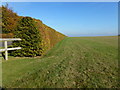
Hedge on the edge
This hedge on the edge of The Limekilns training area in Newmarket is typical of many which screen horses and jockeys from road traffic
Image: © Richard Humphrey
Taken: 28 Oct 2011
0.09 miles
9
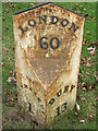
To Newmarket 1
Old milepost Newmarket, Suffolk on part of what was the A.45 / A.11. For overall view see http://www.geograph.org.uk/photo/1211652 For more info see http://milestones.megalithia.com/sites/tl655648.htm do look at their home page.
Image: © Keith Evans
Taken: 19 Mar 2009
0.10 miles
10
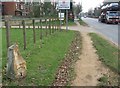
Old Milepost
Old milepost Newmarket, Suffolk on what was the old A.45 / A.11. For close up view see http://www.geograph.org.uk/photo/1211662 for info on the post see http://milestones.megalithia.com/sites/tl655648.htm do look at their home page.
Image: © Keith Evans
Taken: 19 Mar 2009
0.11 miles