IMAGES TAKEN NEAR TO
London Road, NEWMARKET, CB8 0TR
Introduction
This page details the photographs taken nearby to London Road, CB8 0TR by members of the Geograph project.
The Geograph project started in 2005 with the aim of publishing, organising and preserving representative images for every square kilometre of Great Britain, Ireland and the Isle of Man.

There are currently over 7.5m images from over14,400 individuals and you can help contribute to the project by visiting https://www.geograph.org.uk
Image Map
Images are licensed for reuse under creativecommons.org/licenses/by-sa/2.0
Notes
- Clicking on the map will re-center to the selected point.
- The higher the marker number, the further away the image location is from the centre of the postcode.
Image Listing (8 Images Found)
Images are licensed for reuse under creativecommons.org/licenses/by-sa/2.0
Image
Details
Distance
1
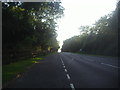
Layby on the A1304 near Six Mile Bottom
Image: © David Howard
Taken: 26 Jul 2012
0.06 miles
2
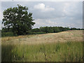
Harvested crop
Nice to see an area of land round here producing something, vast areas are used for horse racing, training and breeding.
Image: © Hugh Venables
Taken: 24 Jul 2010
0.14 miles
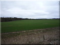
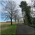
4
Minor road towards Dullingham
Heading east.
Image: © JThomas
Taken: 19 Mar 2016
0.21 miles
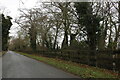
5
Station Road
Heading away from Dullingham station.
Image: © Robin Webster
Taken: 3 Oct 2015
0.21 miles
6
Swaffham Heath Road near Six Mile Bottom
Image: © David Howard
Taken: 13 Feb 2022
0.21 miles
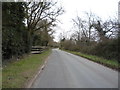
7
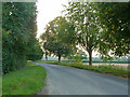
On the way to Dullingham
This lane leads from the A1304 between Six Mile Bottom and Newmarket to Dullingham and on to Stetchworth. Gran's Plantation is in the middle distance to the left of centre.
Image: © John Sutton
Taken: 11 Mar 2023
0.22 miles
8
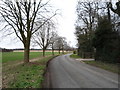
Minor road towards Dullingham
Heading east.
Image: © JThomas
Taken: 19 Mar 2016
0.22 miles