
IMAGES TAKEN NEAR TO
Church Road, ELY, CB7 5XT
Introduction
This page details the photographs taken nearby to Church Road, CB7 5XT by members of the Geograph project.
The Geograph project started in 2005 with the aim of publishing, organising and preserving representative images for every square kilometre of Great Britain, Ireland and the Isle of Man.

There are currently over 7.5m images from over14,400 individuals and you can help contribute to the project by visiting https://www.geograph.org.uk
Image Map
Images are licensed for reuse under creativecommons.org/licenses/by-sa/2.0
Notes
- Clicking on the map will re-center to the selected point.
- The higher the marker number, the further away the image location is from the centre of the postcode.
Image Listing (90 Images Found)
Images are licensed for reuse under creativecommons.org/licenses/by-sa/2.0
Image
Details
Distance
1
![Wicken houses [13]](https://s3.geograph.org.uk/geophotos/06/72/58/6725859_0398b274_120x120.jpg)
Wicken houses [13]
Vicarage Farmhouse, number 2 Cross Green, a former farmhouse is a substantial house built in gault brick.
Wicken is a small village some 10 miles north east of Cambridge and 5 miles south of Ely. There are traces of occupation from the Stone Age, Bronze Age, Roman and Anglo-Saxon periods. The village is the site of Wicken Fen National Nature Reserve.
Image: © Michael Dibb
Taken: 9 Sep 2020
0.14 miles
2
![Wicken houses [15]](https://s3.geograph.org.uk/geophotos/06/72/58/6725863_83c0fc2a_120x120.jpg)
Wicken houses [15]
Number 3 Cross Green is a late 16th or early 17th cottage with an original hall and cross passage plan. Timber framed and stuccoed. At the time of listing (1983) the roof was of corrugated iron, now happily returned to thatch. Listed, grade II, with details at: https://historicengland.org.uk/listing/the-list/list-entry/1161034
Wicken is a small village some 10 miles north east of Cambridge and 5 miles south of Ely. There are traces of occupation from the Stone Age, Bronze Age, Roman and Anglo-Saxon periods. The village is the site of Wicken Fen National Nature Reserve.
Image: © Michael Dibb
Taken: 9 Sep 2020
0.15 miles
3
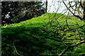
Wicken Hall ice house
The turf-covered mound as seen from the churchyard of St Laurence. For a view from the other side and more information see Image
Image: © Tiger
Taken: 25 Mar 2020
0.16 miles
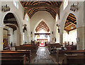
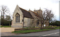
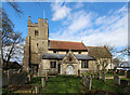
7
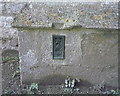
OS Flush Bracket 1362 Wicken
Wicken Church
www.bench-marks.org.uk/bm625
Image: © Richard Neale
Taken: 1 Nov 2001
0.16 miles
8
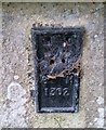
Ordnance Survey Flush Bracket (1362)
This OS Flush Bracket can be found on the west face of St Lawrence's Church. It marks a point 10.147m above mean sea level.
Image: © Adrian Dust
Taken: 9 Jan 2019
0.16 miles
9
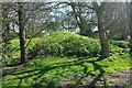
Ice house at Wicken Hall
Visible from the A1123 Church Road, this domed structure shaded by trees and covered with turf is characteristic of an old ice house which would have served the Grade II listed Wicken Hall https://britishlistedbuildings.co.uk/101126420-wicken-hall-wicken
Ice would have been cut in winter, probably from the nearby Wicken Fen, and used to keep provisions cool and fresh during the summer.
The hall itself lies behind the belt of trees and is described by Pevsner as a modest three-bay house of around 1600, with a stair turret and mid-18th century facade on the far side.
Image: © Tiger
Taken: 25 Mar 2020
0.16 miles
10
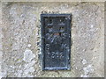
Ordnance Survey Flush Bracket 1362
This can be found on the wall of St Laurence Church in Wicken.
For more detail see : http://www.bench-marks.org.uk/bm625
Image: © Peter Wood
Taken: 20 Feb 2015
0.16 miles