
IMAGES TAKEN NEAR TO
Heron Croft, ELY, CB7 5WA
Introduction
This page details the photographs taken nearby to Heron Croft, CB7 5WA by members of the Geograph project.
The Geograph project started in 2005 with the aim of publishing, organising and preserving representative images for every square kilometre of Great Britain, Ireland and the Isle of Man.

There are currently over 7.5m images from over14,400 individuals and you can help contribute to the project by visiting https://www.geograph.org.uk
Image Map
Images are licensed for reuse under creativecommons.org/licenses/by-sa/2.0
Notes
- Clicking on the map will re-center to the selected point.
- The higher the marker number, the further away the image location is from the centre of the postcode.
Image Listing (26 Images Found)
Images are licensed for reuse under creativecommons.org/licenses/by-sa/2.0
Image
Details
Distance
1
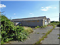
Disused industrial premises, Soham
Formerly Soham Joinery.
Image: © Robin Webster
Taken: 6 Aug 2016
0.10 miles
2
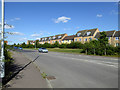
Kingfisher Drive and houses on Bittern Grove, Soham
Both a recent northward extension of the town. The development has roads named after birds appropriate for this watery region.
Image: © Robin Webster
Taken: 6 Aug 2016
0.11 miles
3
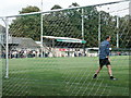
Main Stand, Soham Town Rangers FC
On Julius Martin Lane.
Image: © Stuart Shepherd
Taken: 25 Aug 2008
0.16 miles
4
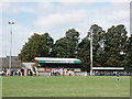
Main Stand, Soham Town Rangers FC (2)
Just before kick-off of the August Bank Holiday home 0-2 defeat to local rivals Bury Town.
Image: © Stuart Shepherd
Taken: 25 Aug 2008
0.18 miles
5
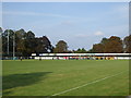
Julius Martin Lane ground - Soham Town Rangers FC
Soham were playing AFC Leamington whose banners can be seen in the far stand.
Image: © nick macneill
Taken: 20 Sep 2008
0.18 miles
6
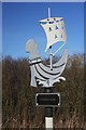
Information post by Soham Lode
Many miles from the sea now, but this sign states: "Here stood a Medieval port on the banks of Soham Mere, which was frequented by merchant vessels from Europe"
Much of the area still known as Soham Mere is below sea-level, and contemporary accounts tell of fleets of vessels sailing in this area, which was connected to the sea in the 1500s.
Image: © Bob Jones
Taken: 8 Feb 2008
0.19 miles
7
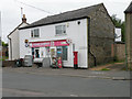
Soham Shopper, Hall Street
The post box is CB7 115
Image: © Keith Edkins
Taken: 4 Jun 2018
0.19 miles
8
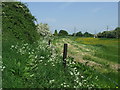
Footpath And Meadow
Footpath and meadow near to Soham, Cambridgeshire.
Image: © Keith Evans
Taken: 22 May 2018
0.21 miles
9

Mixed industrial site, Soham
Off Mere Side. The taller building to the right is outside the site, and is an early twentieth century flour mill, now disused as such.
Image: © Robin Webster
Taken: 6 Aug 2016
0.22 miles
10
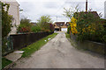
Longmere Lane, Soham
A private road leading down to Mereside.
Image: © Bill Boaden
Taken: 19 Apr 2015
0.22 miles