
IMAGES TAKEN NEAR TO
High Street, ELY, CB7 5PR
Introduction
This page details the photographs taken nearby to High Street, CB7 5PR by members of the Geograph project.
The Geograph project started in 2005 with the aim of publishing, organising and preserving representative images for every square kilometre of Great Britain, Ireland and the Isle of Man.

There are currently over 7.5m images from over14,400 individuals and you can help contribute to the project by visiting https://www.geograph.org.uk
Image Map
Images are licensed for reuse under creativecommons.org/licenses/by-sa/2.0
Notes
- Clicking on the map will re-center to the selected point.
- The higher the marker number, the further away the image location is from the centre of the postcode.
Image Listing (81 Images Found)
Images are licensed for reuse under creativecommons.org/licenses/by-sa/2.0
Image
Details
Distance
1
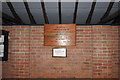
War Memorial in Chippenham bus shelter
Although the memorial carries no names 21 men died in WW1 and five in WW2.
Their names appear on the memorial in the churchyard.
https://www.warmemorialsonline.org.uk/memorial/136089/
Image: © Adrian S Pye
Taken: 18 Jan 2020
0.04 miles
2
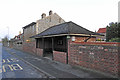
Bus shelter cum War Memorial at Chippenham
The bus shelter is declared to be a consecrated building.
There can't be many of those around!
https://www.geograph.org.uk/photo/6371981
Image: © Adrian S Pye
Taken: 18 Jan 2020
0.05 miles
3
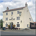
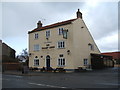
Chippenham: The Tharp Arms
Chippenham's public house takes its name from the owners of Chippenham Park.
"Public House, early C19. Painted local brick, pantiled roof with outshut to rear. Three storeys. Parapet gables, dentil eaves cornice. End stacks and rear stack. Three second-floor four-paned casement windows, two first-floor casement windows in segmental arches and two similar ground floor windows. Entrance has half-glazed door and fanlight with glazing bars in round-headed brick arch" (Grade II listing).
Image: © John Sutton
Taken: 2 Sep 2023
0.06 miles
4
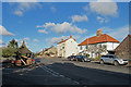
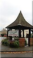
Chippenham High Street and The Tharp Arms
The centre of the village on a bright November morning. The pump is at the corner of Palace Lane.
Image: © John Sutton
Taken: 12 Nov 2017
0.06 miles
7
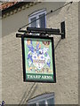
Hanging sign of 'The Tharp Arms' at Chippenham
http://www.geograph.org.uk/photo/5311833
Image: © Adrian S Pye
Taken: 14 Mar 2017
0.06 miles
9
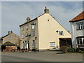
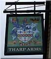
'The Tharp Arms' public house, Chippenham
http://www.geograph.org.uk/photo/5311836
Image: © Adrian S Pye
Taken: 14 Mar 2017
0.06 miles
10
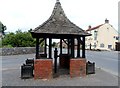
Pump and Tharp Arms, Chippenham
The Tharp Arms is named in deference to the Tharp family who owned Chippenham Park. The Tharp family were involved in slave-owning in the Caribbean (see https://www.ucl.ac.uk/lbs/person/view/274005602 ).
Image: © Bikeboy
Taken: 28 Jun 2014
0.06 miles