IMAGES TAKEN NEAR TO
Gidney Lane, ELY, CB7 5FZ
Introduction
This page details the photographs taken nearby to Gidney Lane, CB7 5FZ by members of the Geograph project.
The Geograph project started in 2005 with the aim of publishing, organising and preserving representative images for every square kilometre of Great Britain, Ireland and the Isle of Man.

There are currently over 7.5m images from over14,400 individuals and you can help contribute to the project by visiting https://www.geograph.org.uk
Image Map
Images are licensed for reuse under creativecommons.org/licenses/by-sa/2.0
Notes
- Clicking on the map will re-center to the selected point.
- The higher the marker number, the further away the image location is from the centre of the postcode.
Image Listing (147 Images Found)
Images are licensed for reuse under creativecommons.org/licenses/by-sa/2.0
Image
Details
Distance
1
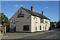
The Ship, Soham
At the southern end of the High Street.
Image: © Robin Webster
Taken: 6 Aug 2016
0.04 miles
2
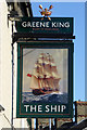
Inn sign, The Ship, Soham
For the whole pub see Image
Image: © Robin Webster
Taken: 6 Aug 2016
0.04 miles
3
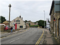
Soham: High Street and The Ship
A pub at the south end of the High Street.
Image: © John Sutton
Taken: 4 Oct 2019
0.05 miles
4
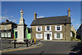
War memorial, Soham
The memorial is a grade II listed 'building'. The house across the way is not.
Image: © Robin Webster
Taken: 6 Aug 2016
0.07 miles
5
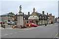
Soham: Red Lion Square
The War Memorial and The Red Lion - and a red car waiting to turn into the High Street. Colour was muted on an overcast October morning.
Image: © John Sutton
Taken: 4 Oct 2019
0.07 miles
6
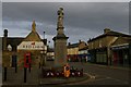
Red Lion Square, Soham
The High Street passing through Red Lion Square was previously the main road from Newmarket to Ely, now carried around the town on a by-pass.
The road to the left is Clay Street, whilst the High Street turns, some way behind the camera, into Sand Street: the low-lying nature of the Fenland landscape presumably means that the soil below one's feet, and most importantly how it behaves when wet, is always of interest.
Image: © Christopher Hilton
Taken: 3 Feb 2020
0.07 miles
8
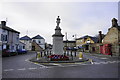
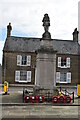
War memorial in Soham
At the junction of Clay Street and High Street.
Image: © Bill Boaden
Taken: 1 Feb 2015
0.08 miles
9
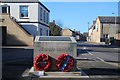
Soham Rail Disaster memorial
This permanent memorial to the Soham Rail Disaster was unveiled on 2nd June 2007 by HRH Prince Richard, Duke of Gloucester, followed by a service in St. Andrew's Church. The memorial in Red Lion Square is situated adjacent to the War Memorial. It is constructed of Portland Stone with embossed text on three top panels detailing the incident thus: "On 2nd June 1944 the town of Soham was saved from certain destruction when an ammunition train carrying bombs in preparation for D-Day, caught fire as it approached Soham station. The train comprised 51 wagons, 44 of which were packed with 250lb and 500lb bombs. Driver Ben Gimbert brought the train to a safe spot in the station, while signalman Frank Bridges sent word of the impending danger from his signal box. Fireman James Nightall went to uncouple the burning wagon from the train and guard Herbert Clarke set off for Barway, placing detonators along the line to warn on-coming trains. The men knew that the burning wagon could explode at any minute, and at 1.43 am, as the population of Soham slept, a huge explosion ensued. Frank Bridges and James Nightall lay dead on the platform. Ben Gimbert was seriously injured and Herbert Clarke, blown to his knees, continued to set detonators. 800 buildings were damaged in the explosion, and many people were injured, but only two died. The actions of these men saved countless lives. Thanks to the recovery operation led by American servicemen this vital line of communications for D-Day was re-opened within 24 hours. Ben Gimbert and James Nightall were awarded the George Cross."
See also http://www.geograph.org.uk/photo/432130 and http://www.geograph.org.uk/photo/3367979
Image: © Bob Jones
Taken: 17 Feb 2015
0.08 miles