IMAGES TAKEN NEAR TO
Silvers Close, ELY, CB7 5ET
Introduction
This page details the photographs taken nearby to Silvers Close, CB7 5ET by members of the Geograph project.
The Geograph project started in 2005 with the aim of publishing, organising and preserving representative images for every square kilometre of Great Britain, Ireland and the Isle of Man.

There are currently over 7.5m images from over14,400 individuals and you can help contribute to the project by visiting https://www.geograph.org.uk
Image Map
Images are licensed for reuse under creativecommons.org/licenses/by-sa/2.0
Notes
- Clicking on the map will re-center to the selected point.
- The higher the marker number, the further away the image location is from the centre of the postcode.
Image Listing (9 Images Found)
Images are licensed for reuse under creativecommons.org/licenses/by-sa/2.0
Image
Details
Distance
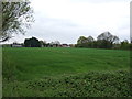
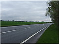
1
A142 Soham bypass
At junction with Hasse Road.
Image: © Hugh Venables
Taken: 8 Nov 2009
0.09 miles
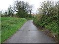
2
Bancroft Drove
Byway away from Hasse Road.
Image: © Hugh Venables
Taken: 8 Nov 2009
0.12 miles
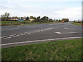
3

A142 bypasses Soham
The road to the right leads to the town centre.
Image: © J.Hannan-Briggs
Taken: 8 Jul 2013
0.13 miles

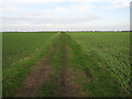
6

Soham Millennium Walk
Part of the seven-mile green route which starts and finishes at St Andrew's Church. http://soham.org/index.php/history/soham-history/89-soham-millennium-walks
Image: © Bob Jones
Taken: 12 Dec 2006
0.19 miles
8
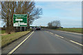
A142 towards Ely approaching Northfield Road Crossroads
On the Soham bypass.
Image: © Robin Webster
Taken: 17 Feb 2018
0.21 miles