
IMAGES TAKEN NEAR TO
Mereside, ELY, CB7 5EE
Introduction
This page details the photographs taken nearby to Mereside, CB7 5EE by members of the Geograph project.
The Geograph project started in 2005 with the aim of publishing, organising and preserving representative images for every square kilometre of Great Britain, Ireland and the Isle of Man.

There are currently over 7.5m images from over14,400 individuals and you can help contribute to the project by visiting https://www.geograph.org.uk
Image Map
Images are licensed for reuse under creativecommons.org/licenses/by-sa/2.0
Notes
- Clicking on the map will re-center to the selected point.
- The higher the marker number, the further away the image location is from the centre of the postcode.
Image Listing (35 Images Found)
Images are licensed for reuse under creativecommons.org/licenses/by-sa/2.0
Image
Details
Distance
1

Mixed industrial site, Soham
Off Mere Side. The taller building to the right is outside the site, and is an early twentieth century flour mill, now disused as such.
Image: © Robin Webster
Taken: 6 Aug 2016
0.09 miles
2
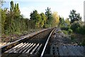
Single track line at Soham
The railway line from Bury St Edmunds to Ely passes to the west of Soham.
Image: © Bob Jones
Taken: 29 Oct 2006
0.09 miles
3
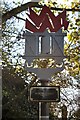
Memorial to railworkers at Soham
The memorial to Frank Bridges and James Nightall. The inscription reads: "Signalman Frank Bridges and Fireman James Nightall died as heroes saving Soham from devastation, along with Engine Driver Ben Gimbert, who survived the train explosion in the early hours of 2nd June 1944."
Image: © Bob Jones
Taken: 29 Oct 2006
0.09 miles
4
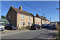
Houses on Mere Side, Soham
Or cottages, as certainly three of the blocks are called. The second block is detached - 'Heatherbrae' - was this the foreman's house?
Image: © Robin Webster
Taken: 6 Aug 2016
0.11 miles
5

Soham: the north end of the new railway station
This new station was opened on 13 December 2021 by the Mayor of Cambridgeshire and Peterborough, Dr Nik Johnson. The combined authority funded the building of the station, at which trains on the Peterborough-Ipswich service stop. This is the view towards Ely, and the information board shows that the 10.49 train is on its way.
Image: © John Sutton
Taken: 26 Feb 2022
0.11 miles
6
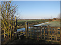
Footpath along Soham Lode
At the end of Spencer Drive which provides access to the Lode across the railway.
Image: © Hugh Venables
Taken: 3 Jan 2010
0.14 miles
7
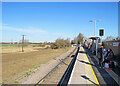
Soham: waiting for the 10.49
This new station was opened on 13 December 2021 by the Mayor of Cambridgeshire and Peterborough, Dr Nik Johnson. The combined authority funded the building of the station, at which trains on the Peterborough-Ipswich service stop. This is the view towards Ely, with a good number of passengers waiting.
Image: © John Sutton
Taken: 26 Feb 2022
0.15 miles
8
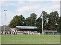
Main Stand, Soham Town Rangers FC (2)
Just before kick-off of the August Bank Holiday home 0-2 defeat to local rivals Bury Town.
Image: © Stuart Shepherd
Taken: 25 Aug 2008
0.15 miles
9
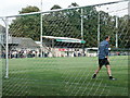
Main Stand, Soham Town Rangers FC
On Julius Martin Lane.
Image: © Stuart Shepherd
Taken: 25 Aug 2008
0.16 miles
10
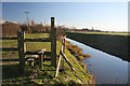
Footpath at Soham Lode
This path follows the eastern bank of the river. There is also a public footpath on the opposite bank.
Image: © Bob Jones
Taken: 8 Feb 2008
0.16 miles