
IMAGES TAKEN NEAR TO
Weatheralls Close, ELY, CB7 5BQ
Introduction
This page details the photographs taken nearby to Weatheralls Close, CB7 5BQ by members of the Geograph project.
The Geograph project started in 2005 with the aim of publishing, organising and preserving representative images for every square kilometre of Great Britain, Ireland and the Isle of Man.

There are currently over 7.5m images from over14,400 individuals and you can help contribute to the project by visiting https://www.geograph.org.uk
Image Map
Images are licensed for reuse under creativecommons.org/licenses/by-sa/2.0
Notes
- Clicking on the map will re-center to the selected point.
- The higher the marker number, the further away the image location is from the centre of the postcode.
Image Listing (3 Images Found)
Images are licensed for reuse under creativecommons.org/licenses/by-sa/2.0
Image
Details
Distance
1
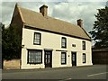
Sundial House in Soham
Formerly the Jolly Gardeners Public House and dated 1781 on sundial to gable end, this grade II listed building stands in Pratt Street.
Image: © Robert Edwards
Taken: 27 Jul 2007
0.17 miles
2
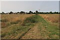
Footpath to Soham
With planning recently agreed for this area to be developed for housing.
Image: © Hugh Venables
Taken: 17 Aug 2024
0.18 miles
3
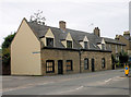
Cottages in Pratt Street
These may have been made to look more of a pair than they really are - the one on the left is described as brick-faced clunch, the right brick built. Both Grade II listed.
Image: © Keith Edkins
Taken: 4 Jun 2018
0.19 miles