IMAGES TAKEN NEAR TO
Station Drove, ELY, CB7 4SR
Introduction
This page details the photographs taken nearby to Station Drove, CB7 4SR by members of the Geograph project.
The Geograph project started in 2005 with the aim of publishing, organising and preserving representative images for every square kilometre of Great Britain, Ireland and the Isle of Man.

There are currently over 7.5m images from over14,400 individuals and you can help contribute to the project by visiting https://www.geograph.org.uk
Image Map
Images are licensed for reuse under creativecommons.org/licenses/by-sa/2.0
Notes
- Clicking on the map will re-center to the selected point.
- The higher the marker number, the further away the image location is from the centre of the postcode.
Image Listing (17 Images Found)
Images are licensed for reuse under creativecommons.org/licenses/by-sa/2.0
Image
Details
Distance
2
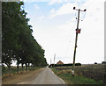
Approaching the former Willow Farmhouse
The building seen in the background used to be Willow farmhouse. Although still marked on OS maps as Willow Farm, the farm has since been taken over and incorporated into a much larger enterprise. The house presently serves as a hostel for seasonal farm labourers. An electricity transformer can be seen in the foreground (right). The road links Engine Farm with the A1101 further to the east. There is no public right of way in this grid square - this view was taken by kind permission of the farm's office staff.
Image: © Evelyn Simak
Taken: 1 Oct 2009
0.01 miles
3
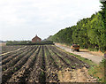
Bringing in the potatoes
A tractor with a trailerload of harvested potatoes is heading towards Engine Farm. The building seen in mid-distance used to be Willow farmhouse. Although still marked on OS maps as Willow Farm the farm has since been taken over and incorporated into a much larger enterprise. The house presently serves as a hostel for seasonal farm labourers. There is no public right of way in this square - this view was taken by kind permission of the farm's office staff.
Image: © Evelyn Simak
Taken: 1 Oct 2009
0.04 miles
5
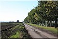
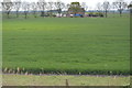
Track to Engine Farm
A private farm track which meets the A1101 at Shippea Hill railway station.
Image: © Bob Jones
Taken: 20 Oct 2007
0.07 miles
8
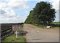
Private road to Engine Farm
There is no public right of way in this square - this view was taken by kind permission of the farm's office staff.
Image: © Evelyn Simak
Taken: 1 Oct 2009
0.15 miles
9
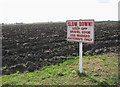
Newly ploughed field
Displaying the dark fertile soil of the Cambridgeshire fenland. There is no public right of way in this square - this view was taken by kind permission of the farm's office staff.
Image: © Evelyn Simak
Taken: 1 Oct 2009
0.16 miles