
IMAGES TAKEN NEAR TO
Houghton Gardens, ELY, CB7 4JN
Introduction
This page details the photographs taken nearby to Houghton Gardens, CB7 4JN by members of the Geograph project.
The Geograph project started in 2005 with the aim of publishing, organising and preserving representative images for every square kilometre of Great Britain, Ireland and the Isle of Man.

There are currently over 7.5m images from over14,400 individuals and you can help contribute to the project by visiting https://www.geograph.org.uk
Image Map
Images are licensed for reuse under creativecommons.org/licenses/by-sa/2.0
Notes
- Clicking on the map will re-center to the selected point.
- The higher the marker number, the further away the image location is from the centre of the postcode.
Image Listing (90 Images Found)
Images are licensed for reuse under creativecommons.org/licenses/by-sa/2.0
Image
Details
Distance
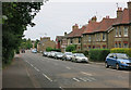
2
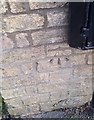
Ordnance Survey Cut Mark
This OS cut mark can be found on No13 Cambridge Road. It marks a point 21.8542m above mean sea level.
Image: © Adrian Dust
Taken: 8 Jan 2019
0.08 miles

4
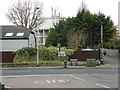
Ely Water Tower
Anglian Water's edifice attempts to hide among the trees
Image: © Keith Edkins
Taken: 6 Dec 2017
0.10 miles
5
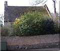
An old house in the St. John's area of Ely
One of a group of buildings shown as St John's Farm towards the left hand edge of
http://www.british-history.ac.uk/image.aspx?compid=21883&filename=fig02.gif
Other buildings in the group are described in
http://www.eastcambs.gov.uk/html/LBDetails.asp?field1=99
and
http://www.eastcambs.gov.uk/html/LBDetails.asp?field1=102
http://www.eastcambs.gov.uk/html/LBDetails.asp?field1=101
implies that the building in the picture is St John's Farmhouse
Image: © Colin Attenborough
Taken: 6 Apr 2007
0.10 miles
6
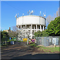
Ely Water Tower
The original tower, built in 1853, was of brick. This concrete one was renovated in recent years (source, British Water Tower Appreciation Society http://bwtas.blogspot.co.uk/2013/10/ely-good-news.html ).
Image: © John Sutton
Taken: 1 Feb 2018
0.11 miles
7
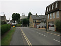
Barton Road, Ely
Looking towards the water tower.
Image: © Hugh Venables
Taken: 2 Jul 2014
0.11 miles
8
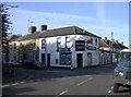
St John's Road Post Office
An endangered species.
Image: © Keith Edkins
Taken: 18 Oct 2007
0.12 miles
9
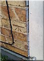
Ordnance Survey Cut Mark
This OS cut mark can be found on No62 Barton Road. It marks a point 24.728m above mean sea level.
Image: © Adrian Dust
Taken: 8 Jan 2019
0.13 miles
10
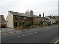
Cambridge Road, Ely
The terrace on the left is built of unusual non-standard bricks, but I can't find anything more about it. It predates the first available OS map, 1885.
Image: © Keith Edkins
Taken: 6 Dec 2017
0.13 miles