IMAGES TAKEN NEAR TO
Twentypence Road, ELY, CB6 3PX
Introduction
This page details the photographs taken nearby to Twentypence Road, CB6 3PX by members of the Geograph project.
The Geograph project started in 2005 with the aim of publishing, organising and preserving representative images for every square kilometre of Great Britain, Ireland and the Isle of Man.

There are currently over 7.5m images from over14,400 individuals and you can help contribute to the project by visiting https://www.geograph.org.uk
Image Map
Images are licensed for reuse under creativecommons.org/licenses/by-sa/2.0
Notes
- Clicking on the map will re-center to the selected point.
- The higher the marker number, the further away the image location is from the centre of the postcode.
Image Listing (6 Images Found)
Images are licensed for reuse under creativecommons.org/licenses/by-sa/2.0
Image
Details
Distance
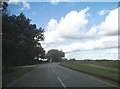
3
Twenty Pence Road (B1049)
Looking south east.
Image: © JThomas
Taken: 12 Aug 2017
0.10 miles
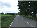
4
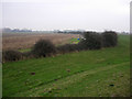
Field near Fair View Farm
Flat land near the River Great Ouse.
View over a drain from Twenty Pence Road (B1049).
Image: © JThomas
Taken: 12 Aug 2017
0.12 miles
5
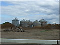
Game rearing
Maize crop left for the birds and a rearing pen.
Image: © Hugh Venables
Taken: 10 Jan 2009
0.23 miles
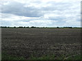
6
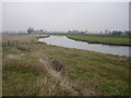
River Great Ouse
Washland each side of the river inside the banks, increasing the volume the river can hold during wet periods when water is pumped off the fields into the river.
Image: © Hugh Venables
Taken: 10 Jan 2009
0.25 miles