
IMAGES TAKEN NEAR TO
Longfields, ELY, CB6 3DN
Introduction
This page details the photographs taken nearby to Longfields, CB6 3DN by members of the Geograph project.
The Geograph project started in 2005 with the aim of publishing, organising and preserving representative images for every square kilometre of Great Britain, Ireland and the Isle of Man.

There are currently over 7.5m images from over14,400 individuals and you can help contribute to the project by visiting https://www.geograph.org.uk
Image Map
Images are licensed for reuse under creativecommons.org/licenses/by-sa/2.0
Notes
- Clicking on the map will re-center to the selected point.
- The higher the marker number, the further away the image location is from the centre of the postcode.
Image Listing (18 Images Found)
Images are licensed for reuse under creativecommons.org/licenses/by-sa/2.0
Image
Details
Distance
1
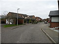
Pilgrims Way
Housing off Witchford Road
Image: © Keith Edkins
Taken: 6 Dec 2017
0.09 miles
2

Norfolk Road
At the junction of Northampton Close. This estate was built in the mid 1990s.
Image: © Keith Edkins
Taken: 6 Dec 2017
0.10 miles
3
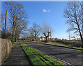
Ely: on Witchford Road
Looking from the cycle track towards some of the new houses of Gateway Gardens.
Image: © John Sutton
Taken: 1 Feb 2018
0.14 miles
5
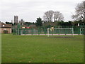
Sports pitches and playground, St John's Road
Opposite St John's school. It's that cathedral again!
Image: © Keith Edkins
Taken: 6 Dec 2017
0.18 miles
6
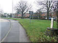
Boundary Marker
Boundary marker of the Turnpike Road Ely, Cambridgeshire for close up view see http://www.geograph.org.uk/photo/1714439
Image: © Keith Evans
Taken: 17 Feb 2010
0.19 miles

8
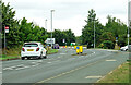
Approaching the A10
Approaching the junction of Witchford Road and the A10 on the south-west side of Ely.
Image: © Mary and Angus Hogg
Taken: 1 Sep 2021
0.19 miles
9

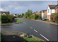
New housing in Ely
Much development has taken place around the city in the last few years. This view is from the Cambridge Road on Ely's southern outskirt.
Image: © Jonathan Billinger
Taken: 15 Apr 2008
0.19 miles
10
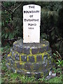
Boundary Marker
Boundary marker of the Turnpike Road Ely, Cambridgeshire for overall view see http://www.geograph.org.uk/photo/1714443
Image: © Keith Evans
Taken: 17 Feb 2010
0.21 miles