IMAGES TAKEN NEAR TO
Main Street, ELY, CB6 2DF
Introduction
This page details the photographs taken nearby to Main Street, CB6 2DF by members of the Geograph project.
The Geograph project started in 2005 with the aim of publishing, organising and preserving representative images for every square kilometre of Great Britain, Ireland and the Isle of Man.

There are currently over 7.5m images from over14,400 individuals and you can help contribute to the project by visiting https://www.geograph.org.uk
Image Map
Images are licensed for reuse under creativecommons.org/licenses/by-sa/2.0
Notes
- Clicking on the map will re-center to the selected point.
- The higher the marker number, the further away the image location is from the centre of the postcode.
Image Listing (14 Images Found)
Images are licensed for reuse under creativecommons.org/licenses/by-sa/2.0
Image
Details
Distance
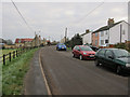
2
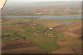
Wardy Hill and the flooded Ouse Washes: aerial 2019
Image: © Chris
Taken: 19 Oct 2019
0.04 miles
3
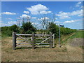
Footpath and byway near Jasmine Farm, Wardy Hill
Image: © Richard Humphrey
Taken: 19 Jul 2013
0.08 miles
4
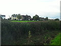
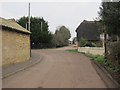
Wardy Hill
Taken from Back Lane across the 6m contour line to the 'heights' of Wardy Hill.
Image: © Andrea
Taken: 7 Oct 2014
0.08 miles
5
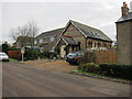
Converted chapel, Wardy Hill
The brick above the porch says "Wesleyan 1903"
Image: © Hugh Venables
Taken: 15 Jan 2012
0.12 miles
6
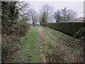
Back Lane, Wardy Hill
Byway around Wardy Hill.
Image: © Hugh Venables
Taken: 15 Jan 2012
0.16 miles
8
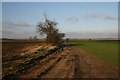
Brock Moors
This track, a public footpath, links the villages of Wardy Hill and Coveney, across a flat fenland area known as Brock Moors..
Image: © Bob Jones
Taken: 23 Jan 2007
0.18 miles
9
Thatched house, Wardy Hill
The footpath follows the track past Vine Leigh Farm. All the paths in this area were well signed.
Image: © Hugh Venables
Taken: 15 Jan 2012
0.18 miles
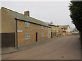
10
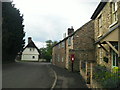
Wardy Hill, Main Street
Looking South West to the end of Main Street, beyond the Post Box on the left is 'Queens Head Cottage' and beyond that on the other side of the road 'Vineleigh Cottage' which is Grade II listed.
Image: © Andrea
Taken: 7 Oct 2014
0.19 miles