
IMAGES TAKEN NEAR TO
The Paddock, ELY, CB6 1TP
Introduction
This page details the photographs taken nearby to The Paddock, CB6 1TP by members of the Geograph project.
The Geograph project started in 2005 with the aim of publishing, organising and preserving representative images for every square kilometre of Great Britain, Ireland and the Isle of Man.

There are currently over 7.5m images from over14,400 individuals and you can help contribute to the project by visiting https://www.geograph.org.uk
Image Map
Images are licensed for reuse under creativecommons.org/licenses/by-sa/2.0
Notes
- Clicking on the map will re-center to the selected point.
- The higher the marker number, the further away the image location is from the centre of the postcode.
Image Listing (169 Images Found)
Images are licensed for reuse under creativecommons.org/licenses/by-sa/2.0
Image
Details
Distance
1
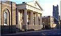
Ely Sessions House
The Sessions House is now used as a court building. The town museum (sloping roof on the right) and Cathedral are visible in the background.
Image: © Colin Attenborough
Taken: 18 Nov 2006
0.04 miles
4

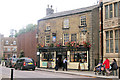
House on Lynn Road junction, Ely
The interesting and unanswered question is what are the "S" cast signs for. They appear on several of the road junctions in Ely and look to have been there for many years.
Image: © Michael Trolove
Taken: 5 Jul 2009
0.09 miles
6
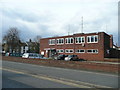
Ely Police Station
1960's municipal building north of Nutholt Lane, Ely.
Image: © Jonathan Billinger
Taken: 15 Apr 2008
0.10 miles
7
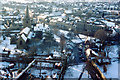
Central Ely from the West Tower of the Cathedral
A windy spot and bitterly cold in the arctic temperature. (I met an Inuit from Arctic Canada who claimed his visit to the tower of Ely Cathedral was the coldest experience of his lifetime).
Image: © Julian Paren
Taken: Unknown
0.10 miles
8

Ordnance Survey Pivot
This OS pivot can be found on the Court House. It marks a point 21.391m above mean sea level.
Image: © Adrian Dust
Taken: 9 Jan 2019
0.11 miles
9
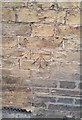
Ordnance Survey Cut Mark
This OS cut mark can be found on No30 Egremont Street. It marks a point 19.620m above mean sea level.
Image: © Adrian Dust
Taken: 9 Jan 2019
0.12 miles
10

Market Street / Lyn Road
Ely museum is located at the corner.
Image: © Mr Ignavy
Taken: 18 Feb 2009
0.13 miles